On 12 December 2014 the gates of a canal head at Taocha, on the shore of the Danjiangkou reservoir in the south-west of Henan province, were opened, and water from the Han River, a tributary of the Yangtze, began to flow northward along a channel more than 1,200 kilometres long towards Beijing. Its arrival in the capital at the end of that month completed the first phase of the central route of the South–North Water Transfer Project, the largest scheme for the movement of water ever undertaken. A year earlier, in late 2013, the first phase of an eastern route had begun to carry water from the lower Yangtze northward through Jiangsu into Shandong, partly along the bed of the ancient Grand Canal. A third, western route, intended to divert water from the upper tributaries of the Yangtze into the headwaters of the Yellow River high on the Tibetan plateau, has been studied for decades but not yet built. Taken together, the routes were planned to move about 44.8 billion cubic metres of water a year from the wet south of China to its dry north, a quantity comparable to the annual flow of a large river. The project is a response to one of the oldest and most persistent facts of Chinese geography, the uneven distribution of water between the two halves of the country.
A divided country
The basins of the Yangtze and the rivers to its south receive most of China’s rainfall. The north, comprising the basins of the Yellow River, the Huai and the Hai, together with the north-east and the arid north-west, has a large share of the country’s farmland and population but a small share of its water. By the estimates commonly cited by Chinese water planners, the north contains roughly two-fifths of the population and a larger proportion of the arable land, but only about a fifth of the water resources. The North China Plain, the great alluvial lowland between Beijing and the Huai River, is the most acute case. Its rainfall is concentrated in a short summer season and varies greatly from year to year, and its rivers, fed by mountains of modest height, carry little water for much of the year.
For most of Chinese history the response to this imbalance was to move grain rather than water. The Grand Canal, built in stages from the fifth century BC and completed in its classic form under the Sui and Yuan dynasties, carried rice and tax grain from the Yangtze delta to the northern capitals, including Beijing from the thirteenth century onward. Irrigation in the north depended on wells, on the seasonal floods of the rivers and on local works, and the Yellow River, with its heavy load of silt and its tendency to break its banks and change its course, was as much a source of disaster as of water.
In the twentieth century the demands on northern water rose dramatically. The population of the North China Plain grew rapidly, irrigation expanded with the drilling of tube wells from the 1960s onward, and the industrial and urban growth of Beijing, Tianjin and the cities of Hebei, Henan and Shandong consumed ever larger quantities. By the 1980s and 1990s the effects were plain. The Hai River system, which drains the plain around Beijing and Tianjin, had been so heavily dammed and drawn upon that many of its channels ran dry for much of the year. The Yellow River itself failed to reach the sea in most years of the 1990s, and in 1997 its lower course was dry for 226 days. Groundwater beneath the North China Plain was pumped faster than it was replenished, and water tables fell by tens of metres in some places, causing land subsidence, the intrusion of salt water near the coast and the drying of springs and wetlands.
A phrase from 1952 and decades of planning
The idea of a transfer from south to north is usually traced to a remark attributed to Mao Zedong in October 1952, during an inspection of the Yellow River. “The south has a lot of water, the north has little,” he is reported to have said; “if it can be done, it would be good to borrow a little.” The remark became the slogan of the project and was quoted in almost every official account of it. Surveys of possible routes began in the 1950s. Over the following decades the Yangtze River Water Resources Commission, the Yellow River Conservancy Commission and the Ministry of Water Resources studied dozens of possible lines, ranging from modest canals to visionary schemes for carrying water from the rivers of the Tibetan plateau across the mountains to the north-west.
The first major work that later became part of the project was built long before the scheme was approved. The Han River flows south-east from the Qinling mountains through southern Shaanxi and north-western Hubei to join the Yangtze at Wuhan, and its upper course runs at a height well above the plains of Henan and Hebei to the north. In 1958 construction began on a dam at Danjiangkou in Hubei, where the Han is joined by its tributary the Dan, and the dam was completed in its first stage in 1973, with a crest at 162 metres above sea level. It was built mainly for flood control, power generation and irrigation, but it was designed so that it could later be raised to store water for transfer northward. Engineers also examined the possibility of using the old Grand Canal and the lakes along its route to carry Yangtze water into Shandong, and in the 1960s and 1970s pumping stations were built at Jiangdu, near Yangzhou, to lift Yangtze water into the irrigation canals of northern Jiangsu, a scheme that would also later be absorbed into the project.
Planning accelerated in the 1990s as the drying of the Yellow River and the depletion of groundwater became national concerns. Different ministries and provinces favoured different routes, and the debate over cost, water quality, environmental consequences and the resettlement of people was extensive. In 2002 the State Council approved an overall plan that combined three routes, eastern, central and western, to be built in phases over several decades. Construction formally began on 27 December 2002, with ceremonies in Beijing and in Jiangsu and Shandong.
The first Danjiangkou dam
The dam at Danjiangkou was one of the great works of the early People’s Republic. Construction began in September 1958, at the height of the Great Leap Forward, with a labour force that at its peak numbered about a hundred thousand people, most of them peasants mobilised from the counties of north-western Hubei and south-western Henan. Much of the early work was done by hand, with baskets, carrying poles and wheelbarrows, and the first coffer dams to divert the river were built of earth and stone carried by the workers. The haste of the early years produced defects in the concrete, and in 1962 work on the main dam was suspended while the faults were investigated and repaired. Construction resumed in 1964 under more careful supervision, and the dam was completed in its first stage in 1973, with a hydroelectric station whose generators were brought into service between 1968 and 1973.
The reservoir created by the first dam flooded the valleys of the Han and the Dan above Danjiangkou, including the old county town of Junzhou, whose walls and temples had stood beside the river for many centuries, and the town of Xichuan in Henan. Several hundred thousand people were resettled, some in nearby hills above the new waterline and others in distant parts of Hubei and Henan, and the hardships of the resettlement, carried out with little compensation by later standards, were remembered in the region for decades. The dam succeeded in reducing the floods of the Han, which had regularly inundated the plain around Wuhan.
The choice of Danjiangkou as the source for the central route followed from the dam’s position and from the quality of its water. The upper Han basin, in the Qinling and Daba mountains, is thinly populated and heavily forested in many places, and the river’s water was among the cleanest of any major river in central China. The reservoir’s surface at its normal level lies about a hundred metres above the plain near Beijing, providing enough fall for the water to flow by gravity along the whole route with only a short section of pumping near the capital. Planners also noted that the Han, unlike the Yangtze itself, could be tapped without the construction of pumping stations of enormous capacity, and that the dam had been designed from the beginning to be raised.
The three routes
The plan of 2002 set out three routes, each drawing water from a different part of the Yangtze basin and each serving a different part of the north.
The eastern route takes water from the lower Yangtze near Yangzhou, in Jiangsu, and lifts it northward through a chain of lakes and canals. The terrain rises gently from the Yangtze towards the watershed in western Shandong, and the water must be pumped uphill in a series of thirteen stages, rising in total by about 65 metres, before it can flow by gravity towards the north. The route makes extensive use of the Grand Canal and of the natural lakes along its course, Hongze, Luoma, Nansi and Dongping, which serve as regulating reservoirs. North of Dongping Lake the water passes beneath the Yellow River through a tunnel and continues towards Tianjin, while a branch runs eastward across Shandong to supply the cities of the Shandong peninsula, including Jinan, Qingdao and Yantai. The first phase, completed in late 2013, carries water as far as Shandong.
The central route draws water from the Danjiangkou reservoir on the Han River. Because the reservoir lies higher than the plains to the north, the water can flow by gravity along almost the whole length of the route. The canal runs from the head at Taocha along the western edge of the North China Plain, close to the foot of the Funiu, Song and Taihang mountains, through the provinces of Henan and Hebei, to Beijing, with a branch eastward to Tianjin. The main canal from Taocha to Beijing is about 1,277 kilometres long, and with the branch to Tianjin the total length of the main channels is more than 1,400 kilometres. The route was designed in its first phase to deliver an average of 9.5 billion cubic metres a year, rising in later phases to about 13 billion.
The western route, the most ambitious and least advanced, would divert water from the upper reaches of the Yangtze and its tributaries, the Jinsha, Yalong and Dadu rivers, through tunnels beneath the Bayan Har mountains on the Tibetan plateau into the upper Yellow River. It would supply the provinces of the north-west, including Qinghai, Gansu, Ningxia, Inner Mongolia, Shaanxi and Shanxi. The engineering difficulties, at altitudes above 3,500 metres and in a region of high seismic activity, are formidable, and the environmental and social questions are numerous. Plans have been revised several times, and construction has not begun.
Raising the Danjiangkou dam
The central route required a much larger reservoir at Danjiangkou than the one built in the 1960s and 1970s. Between 2005 and 2013 the dam was raised by about 14.6 metres, bringing its crest from 162 to 176.6 metres above sea level, and the normal storage level of the reservoir was raised from 157 to 170 metres. The enlarged reservoir covers more than a thousand square kilometres, and its storage capacity rose from about 17.5 billion to about 29 billion cubic metres. Raising an existing concrete dam of this size was itself a difficult undertaking, since the new concrete had to be bonded to the old without cracking as it cooled, and engineers developed techniques of surface preparation and temperature control for the purpose.
The enlargement of the reservoir flooded towns, villages and farmland along the Han and the Dan in the provinces of Hubei and Henan, and required the resettlement of about 345,000 people, in addition to the several hundred thousand who had been moved when the dam was first built. The resettlement was carried out mainly between 2009 and 2012, one of the fastest resettlement programmes of its size undertaken in China. People from the reservoir area were moved to new villages and towns, some nearby and some in other counties of Henan and Hubei, with compensation for houses and land and allocations of new farmland. Reports in the Chinese press and studies by Chinese and foreign researchers described both the achievements and the difficulties of the programme, including disputes over compensation, the quality of the land allocated in the new villages, and the problems faced by families separated from the river and the hillside fields on which they had depended. The experience drew on, and was compared with, the resettlement of more than a million people for the Three Gorges Dam on the Yangtze itself.
The protection of water quality in the reservoir became a major concern. The water was intended for drinking in Beijing and other cities, and the reservoir and its catchment in southern Shaanxi, north-western Hubei and south-western Henan were subjected to strict environmental controls. Polluting factories were closed or moved, sewage treatment plants were built in the towns of the catchment, the use of fertilisers and pesticides was restricted near the shore, and cage fish farming on the reservoir was banned. Forests were planted on the surrounding hills to reduce erosion. The cost of these measures fell heavily on the counties of the catchment, some of which were among the poorer parts of their provinces, and arrangements were made for the receiving cities, including Beijing and Tianjin, to provide assistance and investment in return.
Building the central canal
The construction of the central canal was carried out by many contracting organisations working on separate sections at the same time, under the overall direction of a construction committee of the State Council and a project company formed for the purpose. The canal is for most of its length an open channel with a trapezoidal cross-section, lined with concrete and protected by a layer of impermeable membrane beneath the lining to prevent leakage. It is typically several tens of metres wide at the surface and about seven to nine metres deep, and it was designed to carry a flow of up to 350 cubic metres per second at its head, diminishing northward as water is drawn off to the cities along the route.
Because the canal runs along the foot of the mountains, it crosses hundreds of rivers and streams that flow eastward onto the plain. Where these meet the canal, the engineers had to decide whether to carry the canal over the river by an aqueduct, to take it beneath the river by an inverted siphon, or to pass the river over the canal. The completed route includes more than 1,700 structures of various kinds, including aqueducts, siphons, culverts, bridges and control gates. Among the largest is the Shahe aqueduct in Henan, a series of prestressed concrete troughs carried on piers, several kilometres long, which takes the canal across the Sha River and its floodplain. The most celebrated is the crossing of the Yellow River north-west of Zhengzhou, where the canal passes beneath the riverbed through two parallel tunnels each about 4.25 kilometres long and seven metres in internal diameter. The tunnels were bored by shield machines through the loose, water-saturated silts and sands of the riverbed, the first time such a crossing had been attempted beneath the Yellow River, and they were lined with an inner and an outer shell to withstand the pressure of the water.
The soils along parts of the route presented their own problems. Long sections in Henan and Hebei run through expansive clays, which swell when wet and shrink when dry, and which can cause the slopes of a canal to slide. These sections were stabilised by replacing part of the soil, covering the slopes with protective layers and installing drainage. In places the canal had to be cut deep into the ground, while elsewhere it was raised on embankments above the surrounding land, which required careful compaction to prevent leaks. Towards Beijing the open canal gives way to buried pipes and tunnels: in Hebei and Beijing the water is carried through large prestressed concrete pipes and through tunnels beneath the city, terminating at the Tuancheng Lake regulating reservoir near the Summer Palace and at treatment works across the city.
The central route also required works downstream on the Han River itself. Since a large part of the Han’s flow would be diverted northward from Danjiangkou, the river below the dam would carry less water, with consequences for navigation, irrigation and water quality in the cities of the middle Han valley, including Xiangyang. To compensate, a canal was built from the Yangtze at Jingzhou to the Han at Qianjiang, about 67 kilometres long, which transfers water from the Yangtze into the lower Han. It was completed in 2014. Dams and locks were also built on the middle Han to maintain water levels for navigation and irrigation.
The eastern route and the problem of pollution
The eastern route faced a different problem. Its water source, the lower Yangtze, is abundant, and the engineering of pumping stations and canals was relatively straightforward, since much of the route followed existing waterways. But the water passing through the lakes and canals of northern Jiangsu and western Shandong had in the 1990s been heavily polluted by industrial and municipal waste and by runoff from farmland, and Nansi Lake in particular was considered one of the most polluted lakes in the region. Planners recognised that the route would be useless for drinking water unless the pollution was controlled.
The governments of Jiangsu and Shandong accordingly carried out extensive programmes of pollution control along the route between the early 2000s and 2013. Hundreds of polluting factories, especially paper mills, chemical works and breweries, were closed or required to install treatment facilities; sewage treatment plants were built in the cities and towns along the canal; and wetlands were constructed to filter runoff before it reached the lakes. Fishing nets and cages on the lakes were reduced. By the time the first phase opened, the water quality along the main channel had improved to the standards required for the transfer, according to official monitoring, although critics noted that maintaining it depended on the continued enforcement of strict rules in a densely populated and industrialised region.
The pumping stations of the eastern route lift a large volume of water through the series of stages north of the Yangtze, each consisting of a group of large axial-flow or mixed-flow pumps. The station at Jiangdu, the oldest, was built in the 1960s and 1970s and was later modernised; new stations were built at intervals along the route. The energy required to lift the water is substantial, and the cost of electricity is a significant part of the cost of the water delivered. Beyond the watershed at Dongping Lake the water flows by gravity, partly through the Yellow River tunnel at Dongping and then northward along canals towards Dezhou and, in a later phase, Tianjin.
The eastern branch across Shandong serves a peninsula with no large rivers of its own. The cities of the Jiaodong region, Qingdao, Yantai and Weihai, grew rapidly from the 1980s as ports and manufacturing centres, and repeatedly suffered shortages in dry years, when reservoirs fell and rationing was imposed. A canal and pipeline system carrying Yellow River water eastward across the peninsula had been built in stages from the 1980s, and the eastern route connected with it, allowing Yangtze water to be delivered to the peninsula’s cities in addition to water drawn from the Yellow River. In the drought years of the late 2010s the transferred water was credited with preventing serious shortages in several of these cities. The branch illustrates a general feature of the project: rather than a single canal delivering water to a single destination, it became a framework connecting many existing reservoirs, rivers and local supply systems into a larger network.
Arrival in Beijing
Water from Danjiangkou reached Beijing at the end of December 2014, about two weeks after the gates at Taocha were opened, and entered the city’s treatment works at the start of 2015. Even before that date, Beijing had received water from the northern part of the central route: a section between the Gangnan, Wangkuai and other reservoirs of Hebei and Beijing had been completed in 2008 and used to deliver emergency supplies from Hebei reservoirs to the capital during the dry years before the full canal opened.
The water from the south had an immediate effect on the capital’s supply. Within a few years it had become the source of the majority of the water supplied to the city’s main urban districts, a share frequently reported at around seven-tenths, and it allowed the city to reduce its pumping of groundwater and to store water in its reservoirs, including the Miyun reservoir north of the city, which had been greatly depleted. Tianjin, which had depended for decades on transfers from the Luan River in the north-east and on emergency diversions from the Yellow River, received water from the central route through its eastern branch. Cities along the route in Henan and Hebei, including Zhengzhou, Shijiazhuang and Baoding, also drew a large share of their supply from the canal. By the early 2020s official sources reported that the eastern and central routes together had delivered more than fifty billion cubic metres, and the figure has continued to rise, with tens of millions of people in the north depending on the transferred water for some or all of their supply.
Residents also noticed a change in the water itself. The water of the Han is much softer than the groundwater that had previously supplied much of Beijing, and the city’s water authorities reported that the hardness of tap water in districts served by the canal fell from roughly 380 to around 120 to 130 milligrams per litre, reducing the scale that had long formed in kettles and boilers. The change also required care at the treatment plants, because water of a different chemistry can disturb the deposits that have built up inside old pipes and cause discolouration. Beijing built new plants for the transferred water, among them the Guogongzhuang plant in the south-west of the city, and at first blended the southern water gradually with existing supplies while the distribution network adjusted.
Groundwater and the rivers of the north
One of the aims of the project was to allow the North China Plain to stop overdrawing its groundwater. In the years after 2014 the governments of Beijing, Tianjin, Hebei, Henan and Shandong closed large numbers of wells in areas served by the canals, restricted the pumping of deep groundwater for irrigation and industry, and used transferred water to replace it. The Ministry of Water Resources launched a programme of groundwater recovery across the plain in 2019. Monitoring by Chinese agencies and studies by Chinese and foreign researchers using satellite measurements of the earth’s gravity field reported that the decline in groundwater levels slowed in many areas after the transfer began, and that shallow groundwater levels rose in parts of Beijing and Hebei, though deep aquifers, which recharge very slowly, remained depleted in many places.
Part of the transferred water was also used to restore the flow of northern rivers. From 2018 water from the central route was released into rivers of Hebei and Beijing that had been dry for years, including the Hutuo, the Yongding and the Juma, and into the wetlands of Baiyangdian, the largest freshwater lake of the North China Plain, which lies within the area of the new city of Xiong’an. These releases, described as ecological replenishment, restored surface water to stretches of river that had carried none for decades and contributed to the recharge of groundwater along their beds. Their scale varied from year to year according to the availability of water at Danjiangkou.
Costs, prices and debate
The cost of the first phases of the eastern and central routes, including the raising of the Danjiangkou dam, resettlement and pollution control, was put at more than two hundred billion yuan, making the project one of the most expensive infrastructure programmes undertaken in China. It was financed by a combination of central government funds, a dedicated surcharge on water fees in the receiving provinces, bank loans and contributions from the local governments along the routes. The water delivered was more expensive than local supplies, since its price had to cover a share of the cost of construction and, on the eastern route, the cost of pumping. Some cities along the routes initially took less water than had been allocated to them, preferring cheaper local sources, and the authorities introduced pricing and allocation measures intended to encourage the use of transferred water and to discourage the pumping of groundwater.
The project was the subject of extensive debate among Chinese scientists, engineers and officials before and after its approval, and of discussion abroad. Supporters argued that no combination of water saving, recycling and local measures could meet the needs of the north without a transfer, and that the depletion of groundwater and the drying of the rivers would otherwise continue. Critics within China questioned the cost, warned of the environmental consequences for the Han River and the Yangtze estuary, and argued that more could be achieved through water conservation, more efficient irrigation and higher water prices in the north. Concern was expressed that reduced flows in the lower Han would worsen pollution and encourage algal blooms there, and that the withdrawal of water from the lower Yangtze might increase salt-water intrusion into the estuary during the dry season, affecting the water supply of Shanghai. Studies carried out after the opening of the routes suggested that some of these effects had occurred on a limited scale, and the authorities adjusted the operation of the reservoirs and compensatory works accordingly. The water law reforms of the 2010s, which set national targets for total water use, efficiency and water quality, were in part a response to these debates, and the government described the transfer as only one element of a broader approach to water management that also emphasised saving water in the north.
Climate adds a further uncertainty. The water available at Danjiangkou depends on rainfall in the Han basin, which varies from year to year, and in dry years the reservoir cannot provide its full planned transfer without reducing flows downstream. In the autumn of 2021 heavy rains in the upper Han allowed the reservoir to be filled to its designed normal level of 170 metres for the first time, and the full-level test was regarded as an important confirmation of the safety of the raised dam. In other years drought has reduced the volumes available.
Later phases and related works
The plan of 2002 envisaged the project as a process of several decades. After the completion of the first phases of the eastern and central routes, planning turned to their later stages, which would extend the eastern route to Tianjin and Hebei and increase the capacity of the central route, and to the long-postponed western route. A number of related projects, some of them described as parts of the national water network that the government announced in the 2020s, were also built or begun. A canal and tunnel from the Han River to the Wei River in Shaanxi, which passes beneath the Qinling mountains through a tunnel nearly a hundred kilometres long, was designed to supply Xi’an and the cities of the Guanzhong plain. A transfer from the Yangtze near the Three Gorges into the Han, intended to supplement the water at Danjiangkou, was approved in 2022. Transfers within provinces, such as the diversion of water from the Yangtze to the Huai in Anhui, follow the same logic on a smaller scale.
The project has also been the subject of comparison with water transfers in other countries, including the California State Water Project and the Central Arizona Project in the United States and the Snowy Mountains Scheme in Australia, as well as with abandoned schemes such as the Soviet plans of the 1970s and 1980s to divert the Siberian rivers southward to Central Asia. Its scale exceeds that of any of these.
A canal across the plain
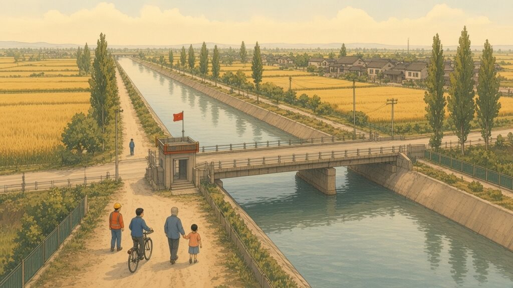
For the people who live along it, the central canal is a new feature of the landscape. It runs for hundreds of kilometres across the plain as a broad, straight channel of clear blue-green water between fenced embankments planted with trees, crossed at intervals by bridges carrying roads and railways, and passing close to cities whose expansion had once been constrained by lack of water. Access to the canal itself is restricted in order to protect water quality and safety, and the embankments are patrolled. In Beijing the water from the south feeds the treatment works that supply the city’s taps and the lakes of its parks, and a small museum and memorial at the Tuancheng Lake terminus tells the story of the project.
The eastern route, by contrast, follows waterways that have carried traffic for many centuries. In Jiangsu and Shandong the transferred water passes along stretches of the Grand Canal that are still used by barges carrying coal, sand and building materials, and through lakes whose fishing villages and reed beds have been part of the region’s life since the canal was first built. In this sense the eastern route returned the old canal to a purpose close to the one for which it was created, the movement of the wealth of the south to the north, though the cargo is now the water itself rather than the grain that it once grew. The project as a whole represents the most ambitious attempt yet made to alter the distribution of a natural resource across a whole country, and its long-term effects on the rivers, aquifers and people of both north and south will be studied for many decades.