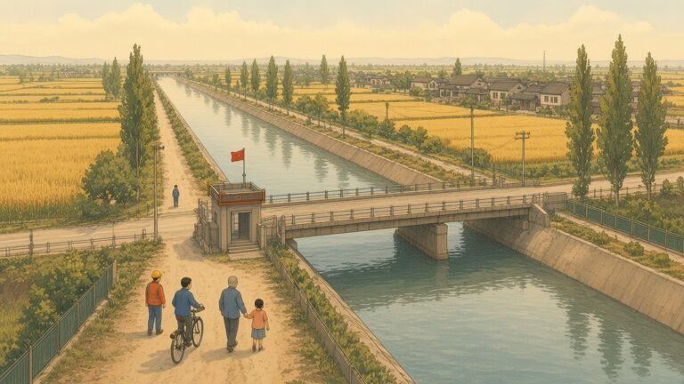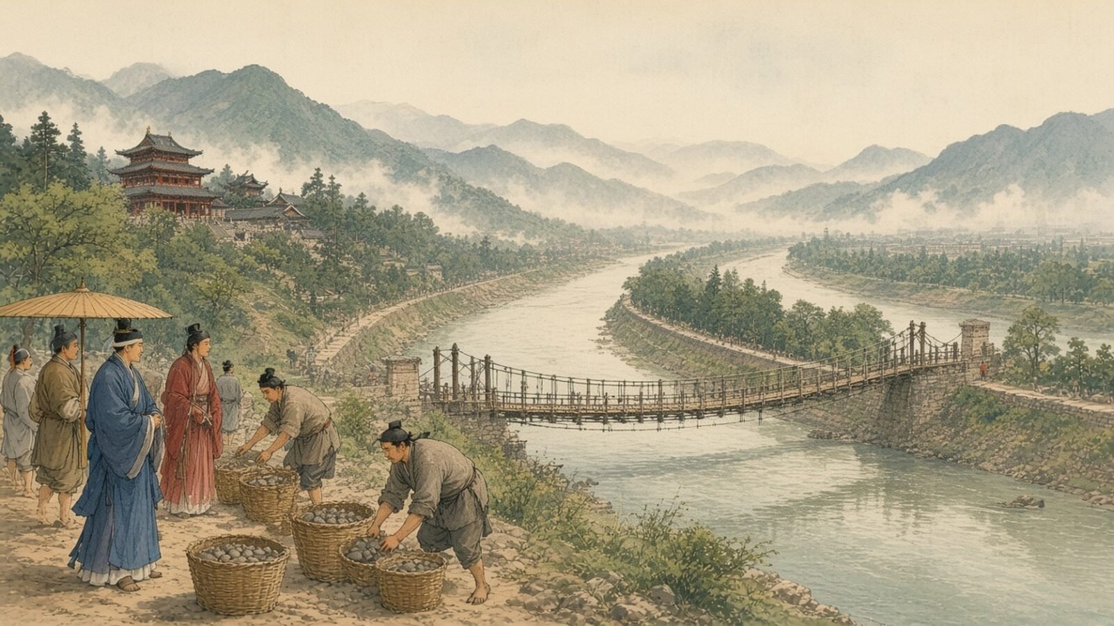
On a bend of the Min River) about an hour outside Chengdu, a low concrete and stone dike angles into the current, dividing the river cleanly in two. There is no dam. The water does not back up behind it. Instead, the dike directs most of the flow into a man-made channel that crosses the Chengdu Plain on a slight downward gradient, while a small regulated stream continues down the natural riverbed. That arrangement, plus two other small weirs a few hundred metres downstream, is the entire headworks of the Dujiangyan irrigation system. It was designed by the Qin engineer Li Bing and his son in 256 BC, more than 2,280 years ago. It is still in continuous use, still irrigating about 5,300 square kilometres of farmland and supplying drinking water to roughly thirty million people, and it was added to the UNESCO World Heritage List in 2000.
Key findings
- The headworks at Dujiangyan were built in 256 BC under the Qin state) by the engineer Li Bing and his son, and the system has been in continuous operation for more than 2,280 years, longer than any other major waterworks on Earth.
- The design uses no dam. A low diversion dike, the Yuzui or “Fish Mouth,” splits the Min River) in two and feeds a man-made canal across the Chengdu Plain; a flood-control weir, the Feishayan or “Flying Sand,” regulates sediment; and a narrow channel, the Baopingkou or “Bottle-Neck,” meters the flow.
- The system today irrigates about 5,300 square kilometres of farmland across the Chengdu Plain and supplies domestic and industrial water to roughly thirty million people, including the city of Chengdu.
- The 2008 Wenchuan earthquake damaged parts of the headworks, but the system was back to operating within a week, and the earthquake actually served as an unintentional stress test of the original 256 BC design.
- The system is the most important single piece of infrastructure in the Sichuan basin, and the work was the foundation of the Chengdu region’s status as one of the most agriculturally productive places in China for the last two millennia.
A river that needed taming
The Min River) drains about 134,000 square kilometres of the eastern Tibetan Plateau and the western edge of the Sichuan basin. At Dujiangyan, about 350 kilometres from the river’s source, the annual flow is around 15 billion cubic metres — comparable to the Rhine at Strasbourg, or about half the Nile at Cairo. The river is also fast: at Dujiangyan the gradient is about eight metres per kilometre, and the river can carry a metre or more of suspended sediment during the summer flood. Until 256 BC the Min River) and the neighbouring Tuo River were a recurrent disaster for the people of the Chengdu Plain. The Shu kingdom)’s annals, preserved in later Chinese dynastic histories, record that the rivers “flooded in summer and dried in winter” and that the people were chronically short of food.
The Chengdu Plain is unusually well suited to irrigation. It is roughly 9,000 square kilometres of flat to gently rolling alluvium, bounded on the west by the Longmen Mountains and on the east by the low hills of the central Sichuan basin. The plain’s soils are deep loess-derived silts and clays washed down from the Tibetan Plateau. Rainfall is high — about 1,000 millimetres a year — and the climate is mild. With water, the plain is one of the most productive agricultural regions in the world. Without water control, however, the same flatness turns into a liability: the rivers shift channels, leave sediment behind them, and either flood the harvest or dry out before it can be brought in.
Li Bing’s brief from the Qin state) was to do something about it. The Qin) under King Zhaoxiang had been expanding south into the Sichuan basin since 316 BC, and the Qin) had concluded that the Chengdu Plain‘s agriculture was a strategic asset worth securing. The project was not just a flood-control effort: it was an instrument of state. Li Bing was appointed as the Qin)’s administrator of the newly conquered Shu commandery) in 256 BC, and the irrigation works were his central task.
The three works
Dujiangyan is built around three simple but precisely calibrated elements. Each one has been modified over the centuries, but the design logic has stayed recognisable since Li Bing’s day.
The first is the Yuzui — the Fish Mouth. It is a low pebble-and-boulder dike that points upstream into the Min River) at the apex of a sharp bend. The dike splits the incoming flow: about 60% goes down the natural riverbed to the south, and about 40% is diverted east into the man-made Neijiang — the inner canal. The geometry of the bend is what does the work: the incoming current strikes the inside of the curve, the dike intercepts the impact, and the resulting pressure differential pushes the desired fraction of water sideways. The original dike was a temporary structure of piled stones, rebuilt every year. Modern Dujiangyan has a permanent reinforced-concrete version, but its alignment and profile still follow the Qin) survey.
The second element is the Feishayan — the Flying Sand Weir. It is a low overflow weir about 500 metres downstream of the Fish Mouth, set across the inner canal at the point where the canal rejoins the natural riverbed. The weir serves two purposes. In normal flow, it keeps the canal at a controlled level, so that water is reliably available to the irrigation network downstream. In flood, the weir’s low crest allows excess water to spill back into the natural riverbed, which then carries it safely past the headworks. The “flying sand” of the name refers to the way the weir is designed to flush accumulated sediment: when the water level rises above the weir’s crest, the high-velocity flow across the weir picks up the bedload and carries it back into the main river. This self-flushing mechanism is one of the most-copied features of the design in modern hydraulic engineering.
The third element is the Baopingkou — the Bottle-Neck Channel. It is the final narrowing of the inner canal, cut through a small hill on the right bank of the Min River) at a point where the canal exits the gorge onto the Chengdu Plain. The Baopingkou is about 20 metres wide and runs through solid rock. It acts as the final metering device of the headworks: the Li Bing design sets the cross-section so that the maximum flow through the canal during a flood cannot exceed the discharge capacity of the downstream channel network. In effect, the Baopingkou is a passive flood-gate that requires no operator.
Together, the three works form what Chinese hydraulic historians call the sanqu — the “three openings.” The genius of the design is that none of the three requires a dam and none requires a moving part. Everything is done with the geometry of the channel, the gradient of the water, and the natural properties of the river’s sediment load. The system has no operator; it operates itself. The annual maintenance, recorded in Qin) and later Han inscriptions carved into the rock walls of the headworks gorge, consists of dredging the inner canal each winter and rebuilding the temporary stone dikes that guide the flood flow.
Working with the river, not against it
The choice of a no-dam design was a deliberate engineering philosophy, not a technological limitation. The Qin) had the technology to build large earth and stone dams, as other contemporary projects in China demonstrate. The Anfeng reservoir in present-day Anhui was built about the same time and used a substantial earthen dam. Li Bing chose differently. The reasons are spelled out in a stele inscription attributed to him and preserved in the Sima Qian tradition: “When the waters are deep, a dam is made of the water itself; when the waters are shallow, a dam is made of stone. The wise man follows the water.”
The practical advantages of the no-dam approach are several. First, it does not require a large workforce to maintain in working order: the channel and the weirs are essentially passive. Second, it does not hold back the river’s natural sediment load, which would otherwise silt up the reservoir behind a dam and progressively reduce the available head. Third, it does not block fish migration, an important consideration in a basin where the Min River)’s fish are a major food source. Fourth, and perhaps most importantly for a 2,280-year-old design, it does not fail catastrophically: a dam, once breached, releases a destructive flood; the Dujiangyan channel simply has too much or too little water, both of which the downstream network can accommodate.
The downstream network, sometimes called the guanzhong — the “irrigation system” proper — is the part of Dujiangyan that the Chengdu Plain actually sees. The inner canal fans out into a network of more than 50 distributaries, each with its own small weir, division gates, and feeder channels. The largest of these is the Baizhang — the Hundred Zhang channel — which carries water from the headworks about 100 kilometres east across the Chengdu Plain to the city of Neijiang. The network was expanded steadily through the Han, Tang, and Song periods. By the Northern Song, the total length of the canal system exceeded 1,200 kilometres.
Maintenance through the dynasties
The system has required continuous maintenance, and the history of that maintenance is part of the system’s identity. The Qin) and Han administrations set up a dedicated maintenance agency — the Duwu — whose staff was responsible for the annual dredging and the repair of the temporary dikes. The Tang reorganised the maintenance as the Dujiangyan jian — the Dujiangyan Repair Office — and increased its budget. The Song introduced a more formal inspection regime, with imperial commissioners visiting the headworks at fixed intervals.
The most ambitious single maintenance project was the Qing dynasty reconstruction of 1874. After a series of floods in the 1850s and 1860s, the headworks were substantially damaged, and the Qing court sent the Sichuan governor to oversee the repairs. The governor, Ding Baozhen, rebuilt the Feishayan weir using the bamboo cage method that had been the standard Qing technique: cylindrical cages of woven bamboo, weighted with stones, and dropped into the river in long lines. The bamboo cage is cheap, fast, and surprisingly durable: a properly built cage can last twenty years in the river. The technique was used at Dujiangyan until the 1950s and is still used in some other parts of Sichuan.
The bamboo cage method is a remarkable example of low-technology infrastructure. A team of three workers can build a cage in a day. The materials — bamboo, willow branches, and stones — are local. The cages are flexible, so they conform to the riverbed and to each other, and they self-repair as silt builds up in the bamboo weave. The technique has been studied by the United Nations Development Programme and is the basis of several low-cost river-training projects in South Asia and Africa.
The 1933 Dujiangyan Flood — a major flood that damaged the headworks — prompted the first modern engineering assessment of the system. The Yangtze River Planning Office, set up in 1932 to manage the river’s flood control, dispatched an engineer named Xu Xinfeng to study the headworks. His report, published in 1934, concluded that the original Li Bing design was fundamentally sound and that the damage was the result of cumulative neglect rather than design flaws. The report recommended a comprehensive restoration, and the restoration was completed in 1936, just before the Second Sino-Japanese War. The 1936 restoration is the version of the headworks that survives today, with later reinforcements.
The 2008 earthquake and the resilience test
The Wenchuan earthquake of 12 May 2008, magnitude 7.9, was centred about 80 kilometres north of Dujiangyan. The earthquake caused extensive damage across the Sichuan basin and was one of the deadliest natural disasters in modern Chinese history. The headworks at Dujiangyan were damaged, and there was a serious question of whether the irrigation system would be functional in the months after the earthquake, when the Chengdu Plain‘s agricultural cycle was at its most vulnerable.
The system performed better than expected. The Yuzui dike was offset by about 30 centimetres by the earthquake, but it did not fail. The Feishayan weir suffered some cracking but continued to function. The Baopingkou — the rock-cut channel — was essentially undamaged, because the Qin) engineers had cut the channel through a competent sandstone that has proved remarkably stable over 2,280 years. The downstream canal network suffered more extensive damage, with several small weirs collapsed and several distributary channels silted up by landslides, but the main canal was operational within a week of the earthquake, and most of the system was fully restored within six months.
The post-earthquake assessment, published by the Sichuan Water Resources Department in 2010, concluded that the Dujiangyan design has intrinsic seismic resilience that modern dam-based systems lack. The conclusion has been controversial: the assessment is partly a defence of the original engineering tradition and partly a real observation. Modern seismic design is calibrated to the Richter magnitude scale and the peak ground acceleration; the original Li Bing design is calibrated to nothing measurable but has survived more than 2,000 years of regional seismicity, including the 2008 event.
Modern use
The system today is operated by the Dujiangyan Management Bureau, a regional government agency under the Sichuan Water Resources Department. The bureau manages the headworks and the principal canals, while the local communes manage the secondary and tertiary channels. The system irrigates about 5,300 square kilometres of farmland, supplying water to roughly 8 million people in the agricultural sector and to about 22 million people in the urban sector, including the city of Chengdu.
The principal crops under the system are rice, wheat, rapeseed, and vegetables. The Chengdu Plain has historically been one of the most productive rice-growing regions in China, and the rice yields under the Dujiangyan system are among the highest in the country. The system also supplies water for the Min River) hydropower stations downstream of the headworks, which have a combined capacity of about 3,000 megawatts. The hydropower is a modern addition: the Qin) headworks have no turbines, and the hydropower plants use the flow regulation provided by the headworks without interfering with the irrigation function.
The water quality is also a significant modern concern. The Min River) above the headworks is among the cleaner rivers in western China, but urban runoff from Chengdu and industrial discharge from the Dujiangyan area have degraded water quality below the headworks. The Sichuan government has run a series of clean-up programmes since 2000, including the construction of a series of wastewater treatment plants in the Dujiangyan and Chengdu area, and water quality has improved substantially.
The 2000 World Heritage inscription
Dujiangyan was added to the UNESCO World Heritage List in December 2000, alongside the Qingcheng Mountain Taoist temples a few kilometres upstream. The inscription was made under criteria (ii), (iv), and (vi) — the system’s intercultural significance, its technological significance, and its association with Taoist thought. The inscription document described Dujiangyan as “a remarkable example of ancient Chinese hydraulic engineering, the only major water conservancy project in the world that has been in continuous use for more than two thousand years without being damaged or destroyed by floods.”
The inscription was a significant moment for the Sichuan provincial government, which had been campaigning for the inscription for nearly a decade. The Sichuan government has since invested heavily in the Dujiangyan area, building a new museum at the headworks, restoring the Qing-era Taoist temples in the gorge, and constructing a modern visitor centre that explains the engineering. The site is one of the most-visited in Sichuan, with about 4 million visitors a year.
The inscription has also had a less-tangible consequence. The Li Bing tradition has been promoted in China as a model of the Taoist principle of working with nature rather than against it. The official Xinhua News Agency account of the 2008 earthquake response, for example, repeatedly cited the Dujiangyan headworks as evidence that Chinese traditional engineering had a long and continuing record of resilience. The use of Dujiangyan as a national symbol is a striking instance of an ancient engineering work being recruited into the modern political vocabulary.
What 2,280 years of continuous use actually proves
Dujiangyan is often described as “still working after 2,280 years,” and the description is technically accurate, but it is also a little misleading. The headworks have been rebuilt several times, the canals have been redredged countless times, and the underlying engineering tradition has been continuously developed. The system is not an artefact. It is a working piece of infrastructure, in continuous use, and its longevity is the result of a continuous tradition of maintenance, modification, and incremental improvement.
This is, in many ways, the more interesting point. Dujiangyan is one of the few ancient engineering works that is not a museum piece. The Roman aqueducts are impressive ruins; the Pont du Gard is a UNESCO site but no longer carries water. The Qin) sections of the Great Wall are mostly rubble. The Dujiangyan headworks, by contrast, are operating infrastructure. They are not a memorial; they are a machine. The machine is 2,280 years old, and it is still running.
The Dujiangyan system also offers an unusual case study in the resilience of low-technology infrastructure. The system was built with hand tools, river cobbles, woven bamboo, and a great deal of engineering judgement. It has been maintained with the same tools, plus, in the 20th century, reinforced concrete and a small amount of mechanical dredging. The system has never required the heavy capital investment or the high maintenance budget of a modern dam, and it has never created the displacement, the ecological disruption, or the safety risk of a modern dam. The system is, in the Taoist sense, an example of wuwei — non-coercive action.
The Dujiangyan is also, in the long view, the reason that Sichuan became one of the most agriculturally productive regions of the Qin) empire and remained so for the next two millennia. The Qin) state that built the Dujiangyan was a small, militarily powerful polity on the western edge of the Central Plains. The Chengdu Plain that the Qin) acquired in 316 BC was a remote and marginally useful territory. The Dujiangyan system transformed the Chengdu Plain into one of the most productive agricultural regions in the world, and that transformation, more than any single battle or any single decision, made the Qin) strong enough to conquer the Warring States in 221 BC and found the Qin empire. The irrigation work that Li Bing and his son did in 256 BC is, in a real sense, the foundation of the Chinese empire.
A model for the 21st century
The Dujiangyan system has been studied by international engineering teams since at least the 1920s, and the conclusions have been remarkably consistent. The system is, in hydraulic terms, exceptionally well engineered: the geometry of the three works, the calibration of the inner canal, and the self-flushing mechanism of the Feishayan are all close to optimal for the site conditions. The system is also, in economic terms, exceptionally cost-effective: the original construction cost has been amortised over more than 2,000 years, and the annual maintenance cost is a small fraction of the cost of operating a comparable modern dam.
The Dujiangyan is also an important case study for the Belt and Road Initiative, the Chinese government’s programme of overseas infrastructure investment. The Chinese government’s promotional literature for the Belt and Road repeatedly cites the Dujiangyan as a model of appropriate-scale, locally-adapted infrastructure. The argument is that the Belt and Road‘s partner countries need context-appropriate infrastructure — small-scale, locally-maintained, environmentally-sound — rather than the mega-dams and mega-roads that the World Bank and the Asian Development Bank have typically funded.
Whether the Dujiangyan model can be exported is a separate question. The system depends on a specific geography — a high-gradient mountain river dropping onto a flat plain — that is not common in Africa or Central Asia. The system also depends on a strong central administration capable of organising the annual maintenance, a condition that the Qin) and the Han provided and that the modern Chinese state continues to provide. The Dujiangyan model is therefore not a universal blueprint, but it is a remarkable example of what can be done when an engineering tradition is allowed to develop over centuries within a stable political framework.
The headworks today
A visit to the Dujiangyan headworks today is a striking experience. The site is a few kilometres outside the modern city of Dujiangyan, which has a population of about 700,000 and is the gateway to the Jiuzhaigou and Huanglong scenic areas. The headworks are reached by a short walk from the Dujiangyan Lidui Park and the Erwang Temple — the temple to Li Bing and his son. The walk crosses the Min River) on a modern bridge and descends to the Fish Mouth — the original Yuzui — which is visible in its modern reinforced-concrete form.
The site is striking because the engineering is so legible. The geometry of the three works is visible from the bank, the calibration of the Baopingkou can be read in the cut-rock walls of the gorge, and the relationship between the Yuzui and the natural river bend is immediately obvious. The system is not a museum piece, but it is also not an industrial site. The water flowing past the Yuzui is the same water that has been flowing past it for 2,280 years.
The Li Bing and his son, who died before the Qin) completed its conquest of China in 221 BC, are commemorated at the Erwang Temple on the right bank of the Min River). The temple is a Qing-era reconstruction, but it occupies the site of an earlier Tang and Song temple, and the Qin) stelae that record Li Bing’s work are still preserved on the cliffs of the gorge. The temple complex is a working religious site, and the annual festival of Li Bing — held on the 24th day of the seventh lunar month — draws thousands of Sichuan pilgrims.
Closing thoughts
The Dujiangyan irrigation system is, in the most literal sense, the most consequential piece of infrastructure in Sichuan‘s modern history. It is the foundation of the Chengdu region’s agricultural productivity, the foundation of the Qin) state’s military power, and the foundation of the Qin empire‘s unification of China in 221 BC. It is also a remarkable engineering achievement in its own right: a 2,280-year-old design that is still in use, still functional, and still expanding.
The Dujiangyan system is one of those rare cases where the ancient and the modern are not in conflict. The system has not been preserved by being kept static; it has been preserved by being used, and used continuously, and used well, for more than two thousand years. The system’s longevity is a tribute not to the Qin engineers alone but to the long tradition of Chinese hydraulic engineering, the Han administrators who expanded it, the Tang and Song officials who maintained it, the Qing engineers who rebuilt it, and the modern Chinese state that has continued to fund the maintenance. The system is, in this sense, a 2,280-year collaboration between past and present.