Most great works of ancient engineering survive as ruins. Dujiangyan is different. On the western edge of the Chengdu Plain in Sichuan, where the Min River bursts out of the mountains, a set of waterworks begun in the third century BC is still doing the job it was built for. Every spring it sends water down thousands of kilometres of canals to farms, towns and factories; every summer it pushes floodwater and gravel back into the river; every winter it is partly taken apart and rebuilt.
It has no great dam. Its core is a long, pointed island in the middle of a river, a low spillway, and a narrow notch cut through a hill. Yet the Sichuan provincial authorities reported in 2024 that the Dujiangyan irrigation district covered 11.548 million mu, about 770,000 hectares, making it the largest irrigation district in China. This is the story of how the Qin state and its successors turned a dangerous river into the most dependable asset in western China, and why the system has outlasted the empire that built it by more than two thousand years.
A river that was too fast, then too slow
The Min River, or Minjiang, is one of the longest tributaries of the Yangtze. It rises in the high country on the edge of the Tibetan Plateau and falls steeply through the gorges of the Longmen Mountains. At the place now called Dujiangyan, the river leaves those mountains almost at once. The ground drops away into the fan-shaped Chengdu Plain, the land flattens, and the current slows abruptly.
That sudden change was the root of the problem. A mountain river carries an enormous load of sand, gravel and cobbles. When it slows, it drops them. Over centuries the Min built up its own bed where it met the plain, so that in spring, when snowmelt and rain swelled the flow, the water spilled out across the lowlands. Meanwhile, land east of a ridge called Mount Yulei could go short of water.
People in the Sichuan Basin had tried to manage the river long before any outside state arrived. Chinese scholars generally accept that the ancient kingdom of Shu carried out earlier works on the Min, and that the famous headworks built on that experience. What changed in the late fourth century BC was scale, money and central direction.
The Qin arrive in Sichuan
In 316 BC the state of Qin, then expanding from its base in the Wei River valley, conquered Shu and its neighbour Ba. The conquest gave Qin something strategically priceless: a large, fertile, enclosed basin protected by mountains, lying upstream of its great southern rival, Chu.
The official most closely associated with that effort is Li Bing, who served as governor of the Shu commandery under King Zhao of Qin, who reigned from 306 to 251 BC. Very little is known about Li Bing as a person. The date usually given for the start of the Dujiangyan project, 256 BC, is a traditional figure; academic writing tends to place his governorship in the final years of King Zhao’s reign, roughly 256 to 251 BC.
The first written record comes from the historian Sima Qian, who around 100 BC included Li Bing in the treatise on rivers and canals in his Records of the Grand Historian. Sima Qian notes that the governor of Shu cut through the rocky outcrop at Lidui, removed the danger of flooding and opened two channels through the Chengdu area, which were used both for boat traffic and for irrigation. A fuller account appears some four centuries later in the Huayang Guozhi, a regional history of the south-west compiled by Chang Qu in the fourth century AD. It is this later text that gives Sichuan the name it still uses with pride: a land where flood and drought answered to human management and famine was unknown, which people called tianfu, a natural storehouse of plenty.
The design: split, spill and squeeze
The obvious way to tame a flood-prone river is to block it. The engineers at Dujiangyan did not. Instead of a dam, they built a system that divides the river, lets the surplus escape, and limits how much can enter the irrigation network. The approach, known in Chinese as wuba yinshui, or diversion without a dam, is the reason the site is still cited by modern engineers.
The headworks have three main parts, which operate together.
The Fish Mouth: dividing the river
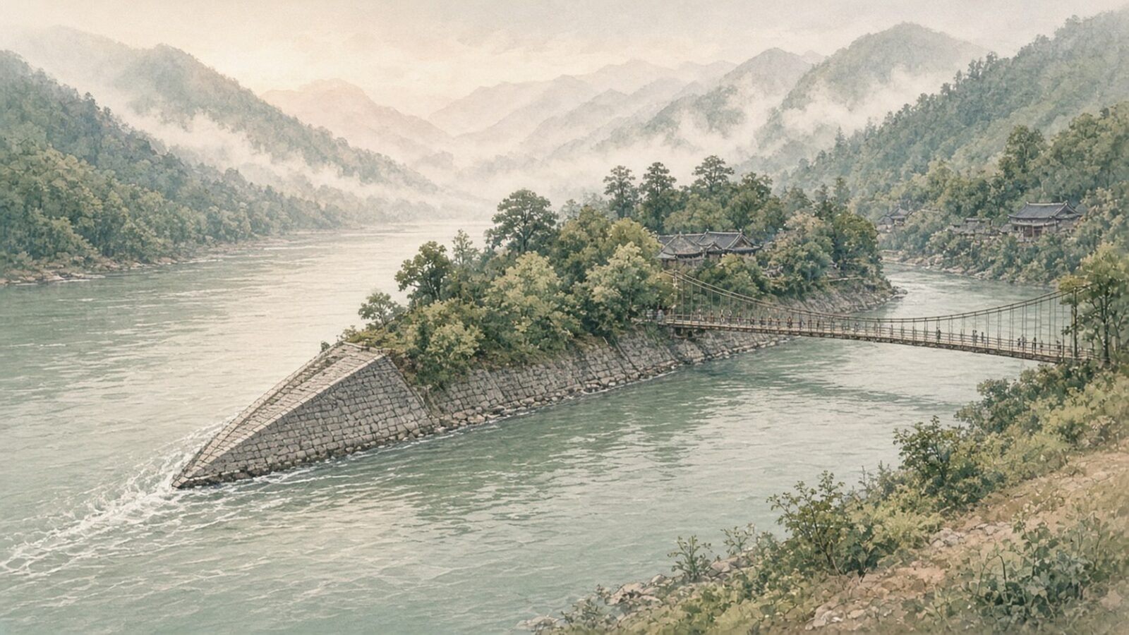
The first element is the Yuzui, or Fish Mouth, a pointed levee that sits in the middle of the Min like the prow of a ship. It splits the river into two branches. To the west is the Outer River, which follows the natural course; it is broad and relatively shallow, and its job is to carry floodwater and sediment away. To the east is the Inner River, deeper and narrower, which feeds the irrigation system.
The clever part is how the split changes with the seasons. The Fish Mouth is placed at a bend, and the two channels are shaped so that in the low-water season of spring, when farmers need water for planting, roughly 60 per cent of the flow goes into the Inner River. When the river is in spate, water rises over the lower ground and the balance reverses, so that about 60 per cent goes to the Outer River and only about 40 per cent to the Inner River. Chinese engineers summarise this in a six-character saying usually rendered as “divide four and six, level out flood and drought”.
The bend matters for sediment, too. On the outside of a curve, water flows faster and near the surface; on the inside, slower currents sweep along the bed. The geometry of the site tends to send surface water towards the Inner River and a larger share of the heavy, bed-hugging gravel towards the Outer River.
The Flying Sand Weir: letting the surplus go
Downstream of the Fish Mouth, along the Inner River, lies the Feishayan, or Flying Sand Weir. It is a deliberately low spillway: the Asian Development Bank, which has studied the site as an example of nature-based flood protection, gives its length as about 200 metres and its height as about 2.15 metres. At normal flows, water passes it by and continues towards the irrigation intake. When the Inner River rises too high, the excess pours over the weir and back into the Outer River.
The name reflects its second function. As water approaches the narrow intake just downstream, it backs up and swirls. That spiralling current throws sand and pebbles sideways and over the weir, flushing sediment that the Fish Mouth failed to divert. Historically built of bamboo and stone, it was designed to fail safely, washing out in very large floods to open a wider escape route. Today the weir is made of reinforced concrete, but its low profile is the same idea.
The Bottle-Neck Channel: the gate to the plain
The final element is the Baopingkou, or Bottle-Neck Channel, a cutting through the end of Mount Yulei. The hill had long blocked water from reaching the eastern side of the plain. Opening a channel through it made irrigation of the plain possible, and the separated outcrop that remained became known as Lidui, the “detached mound” mentioned by Sima Qian.
The channel is roughly 20 metres wide, and it works as a natural regulator. Because the opening is fixed, only so much water can pass through it, however high the river rises. The surplus backs up and flows over the Flying Sand Weir instead. In other words, the narrowness that makes the Bottle-Neck a bottleneck is exactly what protects the farmland below it from being flooded.
How the cutting was made is less clear. Later accounts describe workers heating the rock with fire and dousing it with cold water to crack it, a method known from ancient mining elsewhere. It is plausible, but the earliest sources do not document it.
Built from bamboo, cobbles and timber
If the layout of Dujiangyan is clever, its materials are humble. For most of its history the levees and weirs were built not of cut stone or concrete but of zhulong: long, sausage-shaped cages woven from split bamboo and packed with river cobbles. Stacked in rows, they formed flexible embankments that settled into the shifting gravel without cracking. A Chinese study of the site notes that permanent embankments were hard to build on the deep, loose alluvium of the riverbed, and that bamboo cages filled with large pebbles were the answer.
The other key device was the macha, a tripod of timber poles lashed together. Set in rows across a channel and weighted with stones, then faced with bamboo mats and packed with clay and gravel, macha could form temporary cofferdams. Engineers used them to close off one branch of the river so the bed could be dug out and repaired, and historically also to adjust the split of water between the two branches.
Bamboo rots and cages break, but these materials were cheap, local and could be handled by farmers without specialist skills. A 2006 overview in the journal Irrigation and Drainage stresses exactly this point: the construction methods were easy for farmers to learn and the materials came from the surrounding area, which is why the scheme could be kept going generation after generation.
“Dig the bed deep, keep the weir low”
The real secret of Dujiangyan is not a structure at all. It is maintenance. Because the river keeps dumping gravel into the Inner River and the bamboo works keep decaying, the system would silt up and fail within a few years if left alone. The answer was suixiu, the annual overhaul.
Each winter, when the river was low, workers used macha to shut off one branch, dredged out the accumulated gravel, repaired the cages and embankments, and then repeated the process on the other branch. The water was released back into the canals in spring, in time for planting. The historian Peng Bangben, writing in 2018 in the journal of Xihua University, argues that this regime probably began when the headworks were built and had become an established system by the Han dynasty at the latest.
The guiding rule is a six-character maxim, shen tao tan, di zuo yan, usually translated as “dig the channel bed deep, build the weir low”. The maxim is traditionally attributed to Li Bing himself, and it is carved at the site today.
To make sure each year’s crews dug to the right depth, markers were buried in the riverbed. A Song dynasty text refers to a stone horse beneath the shallows that served as the standard. Later generations replaced it with iron. Today four iron bars, known as wotie or “lying irons”, lie in the bed of the Inner River near the Bottle-Neck. According to Peng’s study and local reporting, they date from 1576, 1864, 1927 and 1994. When the dredgers uncover the irons, they know they have dug deep enough.
Water levels were watched as well. The Huayang Guozhi describes stone figures placed in the river as gauges: if the water fell below their feet, drought threatened; if it rose above their shoulders, flooding did. In March 1974, workers building a sluice gate on the Outer River found a large stone statue of Li Bing in the riverbed. Its inscription records that it was made in AD 168 under two water-management officials of the Eastern Han, Yin Long and Chen Yi. Today it is displayed at the site, and it is often described as among the oldest large stone statues of a person found in China.
An institution as well as a structure
Dujiangyan survived because successive governments treated it as a permanent responsibility with its own officials, budgets and labour. Han inscriptions studied by Peng mention water officials at commandery and county level and a separate body of weir staff who organised the workforce for the annual repairs.
The arrangement carried on after the Han collapsed. In the third century AD, Zhuge Liang, chief minister of the Shu Han state based in Chengdu, is recorded as having assigned 1,200 conscripted men to guard and maintain the weir, under a dedicated weir official. Later dynasties refined the system. Records describe tiers of work, from the annual overhaul to larger periodic repairs and emergency work in floods, with costs shared between the state and the farmers who used the water.
This matters because the headworks were never static. The riverbed shifted, and so did the position of the headworks themselves. One flood, in 910 AD, is recorded as having shifted the weir downstream by a great distance overnight, fixing it close to the site it has occupied ever since the Song dynasty. What endured was not a particular pile of cobbles but a method, and an institution that kept applying it.
When the rules were broken
The system’s history also contains cautionary tales. In the 1870s Ding Baozhen, the governor-general of Sichuan, concluded that decades of under-funded maintenance had left the riverbed choked with gravel and the plain exposed to flooding. He secured funds for a major overhaul, which began in the winter of 1877–78 and finished in the spring. Ding wanted a more durable solution than bamboo cages, so sections of the works were rebuilt with dressed stone blocks, joined with iron and sealed with lime mortar mixed with tung oil.
That summer, a flood tore away part of the new embankments. Critics attacked him for abandoning the bamboo method and questioned the cost, about 130,000 taels of silver. He was punished with dismissal while being kept in office, a common Qing sanction. Later assessments note that several of his structures, including the Fish Mouth, held. But the episode shows how firmly the old principles had become the benchmark against which any change was judged.
Earthquakes, floods and concrete
Dujiangyan sits close to the Longmenshan fault, and its twentieth-century history was shaped by that geology. On 25 August 1933 a magnitude 7.5 earthquake struck Diexi, in the upper Min valley. Landslides blocked the river and its tributaries, creating dammed lakes. On 9 October, after the river had been blocked for about 45 days, one of those natural dams burst. The flood reached Guan County, as Dujiangyan was then known, early the next morning. Estimates from flood marks put the peak flow at about 10,200 cubic metres per second, the largest flood known in the site’s history. It swept away the Flying Sand Weir, embankments and the Anlan suspension bridge, and local records put the death toll in the county at more than 5,000.
The reconstruction that followed marked the site’s entry into the age of modern materials. A Fish Mouth built of stone blocks on a cement foundation was washed away by a flood in 1934 or 1935; accounts differ on the year. In 1936 Zhang Yuan, head of the Sichuan provincial water bureau, oversaw a new design using massive stone blocks bonded with cement, with better foundations. The 1936 Fish Mouth established the modern position of the headworks and lasted until 1974, when it was deliberately removed during construction of a new sluice gate on the Outer River.
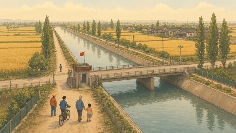
After 1949 the system was expanded on a far larger scale. The main structures were reinforced; new intakes, sluices and industrial water offtakes were added; and the canal network was extended well beyond the historic plain, supported by new reservoirs in the hills. According to official Chinese water-resources material, the irrigated area rose from 2.88 million mu (about 190,000 hectares) in 1949 to nearly 11 million mu by the 1980s.
The biggest change came upstream. The Zipingpu dam, a 156-metre concrete-faced rockfill dam on the Min about 9 kilometres above Dujiangyan city, was completed in 2006. Its reservoir, holding about 1.1 billion cubic metres, gives engineers control over the river’s flow that Li Bing never had.
Both old and new were tested on 12 May 2008, when the Wenchuan earthquake struck with its epicentre only about 17 kilometres from Zipingpu. The dam cracked and settled but remained stable, and the reservoir was drawn down so it could be repaired. At the headworks, early reports said the Fish Mouth had cracked but was not severely damaged, and water continued to be divided between the two channels.
Why the system matters today
It would be easy to treat Dujiangyan as a museum piece that happens to carry water. The numbers suggest otherwise. The 2024 irrigation figure of 11.548 million mu covered land in seven cities, from Chengdu itself to Deyang, Meishan and Mianyang, and included almost six million mu of paddy rice. Provincial officials described the system as the foundation of a higher-level “Tianfu granary”, deliberately echoing the old name for Sichuan.
The purposes of the water are also changing. As Chengdu has grown into one of China’s largest cities, planners now talk about balancing four uses of Dujiangyan water: agriculture, industry, household supply and the environment. A system built to feed a Warring States army now supplies a metropolis of more than 20 million people.
International recognition has followed. UNESCO inscribed the Dujiangyan irrigation system on the World Heritage List in 2000, together with nearby Mount Qingcheng. In 2018 the International Commission on Irrigation and Drainage, meeting in Saskatoon, Canada, added Dujiangyan to its list of World Heritage Irrigation Structures, alongside three other Chinese schemes, including the Lingqu canal in Guangxi.
What engineers take from it
For modern hydraulic engineers, Dujiangyan is interesting less for its age than for its principles. The headworks use the river’s own shape and momentum to sort water from gravel and to limit intake, without pumps or constant adjustment. Traditional structures were built to give way under extreme floods and be repaired in the dry season, the opposite of the logic behind a large concrete dam, which must never fail. Above all, maintenance was part of the design. The German geographer Ferdinand von Richthofen, who travelled through Sichuan in 1872, was among the first Western visitors to describe the system in detail and praise its sophistication. What he was really looking at was the product of a maintenance culture that had outlasted every Chinese dynasty.
Conclusion: the long afterlife of a practical idea
Chengdu likes to think of itself as an easy-going city, and whatever the roots of that reputation, one thing is certain: for more than two millennia the plain has been one of the most reliably productive parts of the country, and that this was not a gift of nature. The land was made fertile by a decision taken by a conquering state, carried out by an official of whom almost nothing personal is known, and then kept working by thousands of unnamed labourers, water officials and farmers.
Dujiangyan today is a hybrid. It has concrete where there were once bamboo cages, a modern dam upstream and concrete sluice gates alongside the old iron markers. But the basic arrangement Sima Qian recorded, with the river split in two and a channel cut through the rock to water the plain, is still there and still working. In an age when infrastructure is often judged by the size of its concrete and the speed of its construction, a waterworks that has run for more than two thousand years makes a quieter case: the most durable projects are those that respect the river, expect to be repaired, and are handed on to people who know how to look after them.