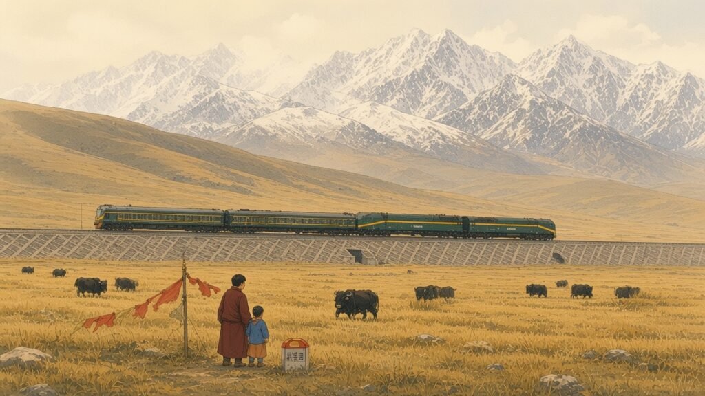
On 1 July 2006 the first scheduled passenger trains left Golmud in Qinghai and Lhasa in Tibet, travelling in opposite directions across the highest plateau on earth. The line they used, the Qinghai–Tibet railway, runs for 1,956 kilometres from Xining, the capital of Qinghai, to Lhasa. Its southern section, the 1,142 kilometres from Golmud to Lhasa built between 2001 and 2005, crosses the Kunlun and Tanggula ranges, runs for about 960 kilometres at altitudes above 4,000 metres and for more than 500 kilometres over permanently frozen ground, and reaches a summit of 5,072 metres near the Tanggula Pass, higher than any other railway in the world. Before its opening, Tibet was the only provincial-level region of China without a railway. The line was the product of half a century of planning, two long interruptions and a set of engineering problems that some foreign engineers had once considered impossible to solve, and it has changed the economy, the demography and the daily life of the plateau through which it passes.
The roads before the railway
For most of its history Tibet was reached from China proper by long caravan routes. The routes from Sichuan and Yunnan through the gorges of the eastern Himalaya, described in the post on the Tea Horse Road, carried brick tea, salt and textiles to Lhasa and horses and medicinal herbs in return. A northern route ran from the region around Xining across the high grasslands of the Changtang, the Tibetan northern plateau, to Nagqu and Lhasa, and was used by pilgrims, traders and the missions of successive imperial governments. Journeys along either route took months.
The idea of a railway into Tibet appeared early in the twentieth century. Sun Yat-sen’s plan for the industrial development of China, written in 1919 and published in English as The International Development of China, included railway lines reaching Lhasa from several directions. The plan remained on paper. After 1950, when the People’s Liberation Army entered Tibet, the new government’s first priority was roads. The Sichuan–Tibet and Qinghai–Tibet highways, built largely by soldiers and labourers under very difficult conditions, opened in 1954. The Qinghai–Tibet highway, from Xining through Golmud to Lhasa, became the main supply route to the region, carrying most of the fuel and goods that entered Tibet for the next fifty years. Golmud, a cluster of tents and huts on the edge of the Qaidam basin when the road-builders arrived, grew into a supply town and then a city.
The first section: Xining to Golmud
Planning for a railway along the highway began in the 1950s. Surveys were carried out in the late 1950s, and in 1958 construction began on the first section, from Xining westward to Golmud, as part of the Great Leap Forward. The work was halted in 1961 during the economic crisis that followed the Leap. It resumed in 1974, and the 814-kilometre line from Xining to Golmud was completed in 1979, though it was not opened to regular passenger traffic until 1984. The section ran along the northern shore of Qinghai Lake, crossed the Guanjiao mountains by a long tunnel and descended into the Qaidam basin, where it served the salt and potash works around Qarhan Salt Lake. The salt crust of the lake was so hard and thick that a stretch of the line was laid directly on it.
The section beyond Golmud was a different matter. Work on the line south towards Lhasa began in the 1970s, and some tunnelling was carried out in the Kunlun range, but in 1978 the project was suspended, chiefly because of the technical problems posed by the permafrost and the altitude, and because of the cost. For two decades the railway ended at Golmud. Goods were transferred there to lorries for the long drive across the plateau, and pipelines laid alongside the highway carried fuel.
The decision to build
Interest in completing the line revived in the 1990s. Several routes were studied, including lines from Sichuan, Yunnan and Gansu, as well as the route from Golmud. The Golmud route was the shortest and the least steep, ran mostly across open plateau rather than through deep gorges, and could draw on decades of experience with the highway along the same corridor. Its main disadvantage was the permafrost. In 2000 the central leadership made the railway a priority project within the programme for the development of the western regions, and in February 2001 the State Council approved construction. Work began on 29 June 2001, with ceremonies at Golmud and Lhasa. The total investment for the Golmud–Lhasa section was put at about 33 billion yuan.
The official arguments for the line were developmental and political. The railway would lower transport costs, which had kept prices in Tibet high and limited trade; it would encourage tourism and the exploitation of the plateau’s mineral resources; and it would bind the region more closely to the rest of the country. The project was also presented as a symbol of the technical capacity of China at the beginning of the new century, comparable in this respect to the Three Gorges Dam on the Yangtze, whose construction was then under way.
Building on frozen ground
The central engineering problem was permafrost, ground that remains below freezing for two years or more. On the Tibetan plateau permafrost is widespread above about 4,300 metres, but it is warmer and thinner than in the Arctic, often only a degree or two below zero, and much of it contains a high proportion of ice. In summer the surface layer thaws, and in winter it refreezes. A structure built on such ground can disturb this balance. An embankment absorbs heat from the sun and insulates the ground beneath it, so that the ice-rich layer begins to thaw; the ground then settles unevenly, and the embankment cracks and sinks. Freezing can also heave the ground upward. The highway along the same route had suffered constant damage from these effects, and engineers had studied them for decades at research stations on the plateau, notably at Fenghuoshan, where the Chinese Academy of Sciences had maintained permafrost observation sites since the 1960s.
The approach adopted for the railway was to keep the ground frozen, or to cool it, rather than to resist its movement. Several methods were used. The most widespread was the crushed-rock embankment, in which the core of the embankment was built of large broken stones rather than fine soil. In winter, cold air sinks into the spaces between the stones and cools the ground beneath; in summer, the warmer air stays at the top, and the stones act as a barrier to the downward flow of heat. Ducts were laid through some embankments to allow cold air to circulate. Along other stretches the embankment slopes were faced with crushed rock or shaded with boards. On the most sensitive ground, thermosyphons, sealed steel pipes partly filled with ammonia or another fluid, were driven into the ground beside the track. In winter the fluid in the buried part of the pipe evaporates, rises and condenses in the cold upper part, carrying heat out of the ground; in summer the process stops, so that the pipes act as one-way valves for heat. Thousands of such pipes line the track on stretches of warm, ice-rich permafrost.
Where the ground was most unstable, the engineers avoided the problem altogether by building bridges. Some 675 bridges were built along the line, with a total length of more than 150 kilometres, many of them long viaducts carried on piles driven deep into the permafrost and raised above the ground so that air could circulate beneath. The longest, the Qingshuihe bridge in the Hoh Xil region, is 11.7 kilometres long. The design of the bridges also served a second purpose, as passages for wildlife.
Golmud and the supply line
The town at which the railway paused for more than two decades owed its existence to the highway. Golmud, whose name comes from a Mongolian word usually translated as “rivers” or “many rivers”, lies where the Golmud River leaves the Kunlun and spreads into the gravel fans of the southern Qaidam basin. When the road-builders under the command of the general Mu Shengzhong arrived in 1954, the site was occupied by a few herders’ encampments, and the builders’ first camp consisted of tents pitched beside the river. Mu Shengzhong, who directed the construction of the highway with a workforce of soldiers and hired camel drivers, became a local hero, and a small building known as the General’s House, where he lived, is preserved in the city as a memorial.
Over the following decades Golmud became the base of the transport organisation that supplied Tibet. Army and civilian lorry depots lined its streets, and the drivers who made the round trip across the plateau, often in convoys and in all weathers, were the main link between Lhasa and the rest of the country. The journey of more than a thousand kilometres took several days, with overnight stops at roadside stations such as Wudaoliang, Tuotuohe and Amdo, and the drivers suffered from altitude, cold and the poor condition of a road that was constantly damaged by the movement of the frozen ground. A fuel pipeline from Golmud to Lhasa, built by the army in the 1970s, ran beside the road. When the railway from Xining reached Golmud in 1979, the town became a transfer point at which goods were moved from wagons to lorries, and it grew into the second city of Qinghai.
The road and the pipeline remained essential after the opening of the railway, but much of the long-haul freight transferred to the line. Golmud’s role shifted from that of a staging post at the end of the railway to a junction on a through route, and later to an industrial city based on the chemical resources of the Qaidam salt lakes, with lines branching westward towards Dunhuang and Xinjiang. The city’s population, which numbered a few tens of thousands in the 1980s, had grown to more than two hundred thousand by the 2010s.
The experience of the highway also shaped the political decision to build the railway. Throughout the second half of the twentieth century the cost of supplying Tibet by road was borne largely by the central government, which subsidised the transport of fuel, grain and goods and maintained the road with a permanent workforce. Planners argued that a railway would reduce this burden in the long run, even though its initial cost was very high, and that it would provide a more reliable link in winter, when snowstorms closed the high passes of the road for days at a time.
Altitude and the workforce
The second great problem was the altitude itself. At 4,500 metres the air contains a little over half the oxygen available at sea level, and at 5,000 metres still less. Acute mountain sickness, with headaches, nausea and exhaustion, affects most newcomers, and more serious conditions, pulmonary and cerebral oedema, can kill within hours if not treated. Tens of thousands of workers were employed on the line during the construction seasons, many of them from lowland provinces. The construction companies and the railway ministry built a network of medical stations along the route, with doctors, oxygen supplies and hyperbaric chambers, in which patients could be treated at increased pressure. Oxygen-generating plants were built at the main work sites, and workers in the high tunnels breathed oxygen while working. Workers were examined before being sent to the plateau, acclimatised in stages and rotated down to lower altitudes. The working season was short, since the ground could only be worked between spring and autumn, and the summers were punctuated by snowstorms. The authorities reported that no worker died of altitude sickness during the construction, a claim that was repeated widely in Chinese accounts of the project and that reflected the scale of the medical arrangements.
The high tunnels presented particular difficulties. The Fenghuoshan tunnel, at about 4,905 metres above sea level, is the highest railway tunnel in the world, and the Kunlun Mountain tunnel, about 1,686 metres long, is among the longest tunnels driven through permafrost. In both, the rock surrounding the bore was frozen and full of ice, and the engineers had to prevent it from thawing during construction and in use. Insulating layers were placed in the tunnel linings, and the tunnels were ventilated in ways designed to keep the surrounding rock cold. The Yangbajing tunnel, closer to Lhasa, was driven through rock at a lower altitude but still well above 4,000 metres.
Wildlife and the plateau grasslands
The route passes through or close to several protected areas, including Hoh Xil, the Sanjiangyuan reserve around the sources of the Yangtze, Yellow and Mekong rivers, and the Changtang. These are the range of the Tibetan antelope, or chiru, the Tibetan wild ass, the wild yak and the Tibetan gazelle, among other species. The chiru had been hunted to near extinction in the 1980s and 1990s for its fine underwool, which was smuggled abroad to be woven into shahtoosh shawls, and its protection had become a matter of national and international concern. Each summer female antelopes migrate north across the line of the highway and the railway to calving grounds in Hoh Xil, and return south with their young.
The railway’s planners provided 33 passages for wildlife, including the spaces beneath the elevated bridges and specially designed underpasses and gentle slopes where the embankment was low. Construction work was suspended in some areas during the migration seasons. Studies carried out by Chinese and foreign biologists in the years after the line opened found that the antelope learned to use the passages, although they hesitated at first and some herds were delayed in crossing. The highway, with its heavier and less predictable traffic, appeared to be a greater obstacle than the railway. Measures were also taken to restore the turf removed from the grasslands during construction; sods of grass were lifted, stored and replanted beside the embankment, with varying success depending on altitude and soil.
The route across the plateau
From Golmud, at about 2,800 metres, the line climbs steadily south up the valley of the Golmud River into the Kunlun mountains. It passes through the Kunlun Mountain tunnel and crosses the Kunlun pass, at about 4,770 metres, onto the high plateau. Beyond lies the basin of Hoh Xil and the Chumar River, a wide, cold, almost uninhabited country of grassland, salt lakes and low hills, across which the line runs for hundreds of kilometres. It crosses the Tuotuo River, one of the headwaters of the Yangtze, near the settlement of Tuotuohe, and climbs to the Tanggula Pass on the border between Qinghai and Tibet. Tanggula station, at 5,068 metres, is the highest railway station in the world. It was built without regular staff and is controlled remotely.
South of the pass the line descends into the Tibet Autonomous Region and the region of Amdo and Nagqu, the old caravan halt of the northern route, where Nagqu station serves the herding country of the northern grasslands. From Nagqu the line passes Tso Na lake, one of the most photographed views from the train, crosses the Damxung plain beneath the Nyainqentanglha range and descends through the valley of Yangbajing, known for its geothermal field, to the Lhasa River. The Yangbajing field, at an altitude of about 4,300 metres some ninety kilometres north-west of Lhasa, has supplied a geothermal power station since 1977, the first of its kind in Tibet, and Damxung, on the plain to the north, is the point from which the road leaves for the high saline lake of Namtso, one of the largest lakes on the plateau. The terminus, Lhasa station, lies on the south bank of the river at Liuwu in the district of Doilungdêqên, a few kilometres from the old city and the Potala Palace. Its design, with long walls and tall windows faced in red and white, was intended to echo the colours of Tibetan monastic architecture.
Trains and equipment
The conditions on the plateau also demanded special trains. Passenger carriages for the line were built by a joint venture between the Canadian company Bombardier and the Chinese manufacturer at Qingdao Sifang. They have sealed windows with ultraviolet filters, and an oxygen supply system that enriches the air in the carriages and feeds individual outlets beside each seat and berth, where passengers can attach tubes. The carriages are not fully pressurised like aircraft cabins, and passengers are required to complete a health declaration before travelling. Doctors travel with the trains, and passengers are advised to acclimatise before going on to the plateau. Diesel locomotives were supplied by General Electric of the United States, modified for the thin air and the cold, with engines designed to maintain power at high altitude. Signalling on the remote parts of the line was largely automatic, with unmanned stations and radio-based control.
Direct trains run to Lhasa from Beijing, Shanghai, Guangzhou, Chengdu, Chongqing, Lanzhou and Xining, among other cities. The journey from Beijing to Lhasa takes about forty hours, and the section from Xining to Lhasa a little over twenty. The trains are ordinary passenger services rather than luxury tourist trains, with hard seats, hard sleepers and soft sleepers, and for much of the year many of their passengers are workers, traders, students and families travelling to and from Tibet rather than tourists.
The science behind the line
The engineering solutions used on the plateau were the result of research that had begun long before construction. From the 1960s scientists of the Lanzhou Institute of Glaciology and Geocryology, part of the Chinese Academy of Sciences, and engineers of the railway ministry’s research institutes had studied the permafrost along the highway corridor, measuring ground temperatures, mapping the distribution of ground ice and observing the damage suffered by roads and buildings. Field stations at Fenghuoshan and Wudaoliang maintained long records of temperature at depth. In the 1970s, during the first attempt to build beyond Golmud, experimental embankments were constructed and monitored, and the lessons of those experiments, together with the experience of the highway, which was rebuilt several times, formed the basis of the designs used after 2001.
Chinese engineers also studied the experience of railways on permafrost elsewhere, particularly in Russia, where the Trans-Siberian and Baikal–Amur lines crossed long stretches of frozen ground and had suffered persistent problems of settlement, and in North America, where the Alaska pipeline had used thermosyphons to protect the ground beneath its supports. A leading figure in the research was the geocryologist Cheng Guodong, who argued for what he called a “cooling roadbed” approach, which sought to lower the temperature of the ground actively rather than simply to insulate it. The crushed-rock embankments, ventilation ducts and shading boards used on the line were all applications of this principle, and they were tested on experimental sections at Beiluhe and elsewhere during the first years of construction before being adopted along the line.
The altitude also demanded research of a different kind. Physicians of the army and of the provincial health services in Qinghai and Tibet had accumulated long experience of mountain sickness among soldiers and road workers, and specialists from these institutions planned the medical arrangements for the construction. The workers’ health records collected during the project were later used in studies of acclimatisation and of the treatment of high-altitude illness.
Operating the line
Running trains on the plateau is a continuous struggle against the climate. Winter temperatures in the Tanggula region fall below minus thirty degrees, and strong winds blow for much of the year, carrying sand and snow across the track. Snow fences and windbreaks were built along exposed sections, and sand-control works of gravel and stone checkerboards were laid out on the plains where dunes threatened to cover the line. Lightning is frequent in the summer storms, and the communication and signalling systems were designed to withstand it. Maintenance crews live at stations along the line, many of them at altitudes above 4,500 metres, working in shifts and descending periodically to recover. The stations of the remote stretches are often no more than a group of low buildings with a few staff, and for some the railway is the only regular link with the outside world.
The ground beneath the track is watched closely. Sensors installed during construction record temperatures inside the embankments and in the permafrost beneath, and the readings are collected and analysed by engineers and scientists. Where settlement appears, the track is raised and realigned, and additional cooling structures have been added on some sections. The experience gained on the line has been applied to other projects across the plateau, including the upgraded highway, power transmission lines carrying electricity into Tibet from Qinghai and, later, from Sichuan and Yunnan, and the oil pipeline from Golmud to Lhasa.
A journey along the line
A traveller leaving Xining in the evening sees first the farmland and poplars of the Huangshui valley, a region of mixed Han, Hui, Tu and Tibetan settlement with a long history as a frontier market between the farming and herding worlds. The train passes the great lake of Qinghai, the largest lake in China, whose shores are grazed by sheep and yaks and lined in summer with fields of yellow rapeseed, and then crosses into the Qaidam basin, a vast desert depression whose floor lies at about 2,700 to 3,000 metres and whose salt lakes and mining towns appear in the night. By morning the train is at Golmud, and the long climb begins.
The hours that follow, across the Kunlun and the plateau beyond, are the heart of the journey. Passengers watch the land grow paler and emptier, the river channels braided and frozen for much of the year, the snow peaks low on the horizon because the plain itself is so high. At the Tanggula Pass the train runs among rounded hills and glaciers before descending into Tibet, where black yak-hair tents and herds of yaks appear on the grasslands around Nagqu, and prayer flags stretch across the passes. By late afternoon the line has dropped into the valley of the Lhasa River, with its barley fields, willows and whitewashed houses, and the train arrives at Lhasa station in the light of the evening. The whole journey from Xining takes about a day, a distance that a caravan from the same region once took two months or more to cover.
Completion and opening
Track-laying proceeded from both ends. The rails from Golmud reached the Tanggula Pass in 2004 and crossed into Tibet, while a second front worked northward from Lhasa. The two met in 2005, and on 15 October of that year the last section of track was laid. A year of testing followed, during which trains ran over the line to settle the embankments and check the performance of the cooling structures and the equipment. The opening ceremony took place on 1 July 2006 at Golmud, where the president, Hu Jintao, spoke before the departure of the first train for Lhasa, and simultaneous ceremonies were held at Lhasa. The opening was timed to coincide with the eighty-fifth anniversary of the founding of the Communist Party.
Construction had been completed about a year ahead of the original schedule, and the line was presented in China as one of the great engineering achievements of the period. The project received the highest national prize for scientific and technological progress, and the techniques developed for building on permafrost were published in a large body of engineering literature. Monitoring stations along the line have since recorded the temperature of the ground beneath the embankments and the settlement of the track. Published studies in the decade after the opening reported that the crushed-rock embankments and thermosyphons had in general kept the underlying permafrost stable or cooled it, while some sections of conventional embankment had suffered settlement and cracking requiring repairs. The long-term performance of the line has become a matter of growing study as the plateau warms; average temperatures on the Tibetan plateau have risen faster than the global average in recent decades, and the permafrost is retreating at its margins.
Traffic and the economy of the plateau
The railway changed the cost of moving goods into and out of Tibet. Before 2006 almost all freight came by road, much of it along the Qinghai–Tibet highway, and the cost per tonne was high. Rail transport was considerably cheaper, and the volume of freight carried into Tibet grew rapidly after the opening. Building materials, fuel, food and consumer goods could be delivered in larger quantities and at lower prices, and the region’s construction boom of the following years depended heavily on the railway. Outward freight was smaller, consisting at first chiefly of minerals and local products. The railway also changed the economy of Golmud and the Qaidam basin, which became a transport hub and an industrial centre for the potash, salt and lithium resources of the region’s salt lakes, whose exploitation is described in the post on the lithium race below the Tibetan plateau.
Passenger numbers exceeded the planners’ expectations. In the first year after opening the line carried well over a million passengers into and out of Tibet, and the number rose substantially in later years. The railway contributed to a large increase in tourism. The number of visitors to the Tibet Autonomous Region, which had been under two million a year before the opening, rose to more than ten million a year by the early 2010s and, according to regional statistics, to several tens of millions by the end of that decade, the great majority of them domestic tourists from other parts of China. Lhasa grew rapidly, with new districts of hotels, shops and apartments around the old city. Foreign visitors continued to require special permits to travel in Tibet, and the issuing of permits was restricted at times of political sensitivity.
The economic and social effects of the line have been described in different ways. The Chinese government has presented it as a central part of the development of Tibet, bringing investment, employment, lower prices and greater contact with the rest of the country, and official statistics show rapid growth in the region’s output and incomes in the years after 2006. Tibetan exile organisations, some foreign governments and a number of foreign scholars expressed concern before and after the opening that the railway would encourage migration of Han Chinese and other non-Tibetans to the region, change the character of Lhasa and other towns, and favour newcomers in employment and trade. Studies of the population and labour market of the region have reached varied conclusions, partly because much migration is seasonal and many migrants are not registered as residents. The debate over the line’s effect on the people of Tibet has continued as part of the wider discussion of the region’s development.
Demand for tickets has been seasonal. In the summer months, when the plateau is at its warmest and most accessible, trains to Lhasa are often fully booked weeks in advance, and the railway has added extra services and longer trains during the peak season. In winter traffic falls sharply, and some services are reduced. The flow of passengers around the Chinese New Year runs in the opposite direction to that of the summer, as workers and students from Tibet travel home and as migrants who work in Tibet return to their families in other provinces. The railway thus came to carry, on a smaller scale, the same rhythms of seasonal migration that shape the national rail network as a whole.
Extensions
The railway was designed to be extended. A branch westward from Lhasa to Shigatse, Tibet’s second city and the seat of the Panchen Lama, opened in August 2014. Its 253 kilometres follow the valley of the Yarlung Tsangpo, the upper course of the Brahmaputra, through a series of tunnels and bridges. A further line eastward from Lhasa to Nyingchi, in the forested valleys of south-eastern Tibet, opened in June 2021 as the first electrified railway in the region, and it forms the western end of the Sichuan–Tibet railway, an even more demanding project under construction across the mountains and gorges of the eastern Himalaya between Chengdu and Nyingchi. Extensions from Shigatse towards the border with Nepal at Gyirong, and a possible line across the Himalaya to Kathmandu, have been studied and discussed by the governments of China and Nepal.
The section from Xining to Golmud, built in an earlier era, was upgraded in the years after 2006, with a second track and electrification, to match the capacity of the plateau section. Lanzhou, Xining and Golmud became links in a growing network of lines across the north-west, including a line from Golmud to Dunhuang and connections into Xinjiang.
The railway and the plateau
For travellers the railway offered a new way of seeing the plateau. The journey across the Changtang by train, with its views of the Kunlun snowfields, the salt lakes and herds of antelope and wild asses, the herders’ tents and prayer flags at the passes, and the long descent to Lhasa, became one of the best-known rail journeys in Asia, and it was the subject of numerous documentaries and travel books in many languages. For residents of Tibet and Qinghai it became an ordinary part of life, a means of travelling to schools, hospitals and work in other provinces and of returning home for the New Year, as well as a route for the pilgrims who still make the journey to the temples of Lhasa from the herding districts of the north.
The line remains the highest and one of the most technically demanding railways in the world. It took the place of the caravan routes and of the highway as the main link between the plateau and the rest of China, and it extended to the roof of the continent the railway network that had been one of the principal instruments of China’s modern development. Its construction drew on decades of research into the behaviour of frozen ground and the physiology of altitude, and its continued operation depends on the care with which that ground is monitored and kept cold as the climate of the plateau changes.