Fly into the Pearl River Delta at night and the old map stops making sense. There is no visible gap between Guangzhou and Foshan, or between Shenzhen and Dongguan. Lights run unbroken along the estuary’s eastern shore, a thinner band links Zhongshan, Zhuhai and Macau on the west, and a dark strip of water marks where Hong Kong begins. Geographers have described regions like this for sixty years, and Guangdong’s planners have spent forty trying to govern this one. Since 2019 it has had an official name: the Guangdong-Hong Kong-Macao Greater Bay Area.
This post looks at how eleven cities around the Pearl River estuary came to be treated as one urban region, from the 1985 open economic zone to the 2019 Greater Bay Area plan. It covers where the idea came from, what the 2019 plan says, what the World Bank’s ‘largest urban area’ claim really measured, the bridges and railways built to hold the region together, the frictions of three customs zones and three currencies that remain, and the critiques. The individual cities have their own stories, several already told on this site. The question here is whether the parts add up to more than a crowded map.
A delta of market towns
The Pearl River is really several rivers. The West, North and East rivers meet near Guangzhou and reach the South China Sea through eight main outlets. For centuries the delta was farmed intensively, with dyke-and-pond systems of mulberry, silkworms and fish, and its market towns traded through Guangzhou, the old Canton, whose history is covered in our post on Canton and Guangzhou. After the Opium Wars, two foreign-run enclaves sat at its mouth: British Hong Kong to the east and Portuguese Macau to the west.
Under Mao these pieces were kept apart. The border at Lo Wu was a hard line: Hong Kong became an industrial and then a financial city facing outwards, while the delta’s counties stayed largely agricultural. That changed in 1979–80, when Shenzhen and Zhuhai became special economic zones next to Hong Kong and Macau, a story told in How Shenzhen Was Built From Border Villages. What matters here is that the reforms soon spread beyond the zones to the whole delta.
From economic zone to city cluster
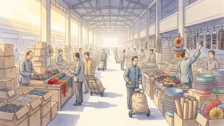
On 18 February 1985 the State Council approved the minutes of a meeting on the Yangtze River Delta, the Pearl River Delta and the southern Fujian triangle, which opened all three as coastal economic open zones. The first Pearl River Delta list included Foshan, Jiangmen, Zhongshan, the then county of Dongguan, and counties such as Panyu, Zengcheng and Bao’an. A 1986 Guangdong government gazette gave the zone about 21,500 square kilometres and some 9.5 million people. The logic was practical. Hong Kong manufacturers facing rising costs could move their factories just across the border and export through Hong Kong. This “front shop, back factory” model made the delta the workshop described in the Dongguan post.
On 8 October 1994, at a provincial party plenum, Guangdong party secretary Xie Fei formally proposed a “Pearl River Delta Economic Zone”: a region to be developed as an integrated economy, with shared infrastructure and a hierarchy of cities rather than a scatter of competing counties. It was still a provincial plan. Hong Kong and Macau were under British and Portuguese administration, and even after their handovers in 1997 and 1999 they lay outside Guangdong’s authority.
Beijing took up the idea next. The Outline of the Plan for the Reform and Development of the Pearl River Delta (2008–2020) was approved in principle by the State Council on 17 December 2008 and published in January 2009, just as the global financial crisis hit the delta’s export factories. It called for industrial upgrading, integrated infrastructure and closer cooperation with Hong Kong and Macau, and it treated nine Guangdong cities as a unit: Guangzhou, Shenzhen, Zhuhai, Foshan, Dongguan, Zhongshan, Jiangmen, Huizhou and Zhaoqing.
Gottmann’s word and the World Bank’s claim
The vocabulary was borrowed. In 1961 the French geographer Jean Gottmann published Megalopolis, a study of the urbanised north-eastern seaboard of the United States from Boston to Washington. He meant a chain of metropolitan areas whose suburbs, transport and economies had grown into one another. In the 2000s the Regional Plan Association’s America 2050 programme popularised “megaregion” for similar networks. Chinese planners settled on chengshiqun, usually translated as “city cluster”.
The delta entered that conversation on 26 January 2015, when the World Bank published East Asia’s Changing Urban Landscape: Measuring a Decade of Spatial Growth, which mapped built-up areas from satellite imagery. Its headline finding was that the Pearl River Delta had overtaken the Tokyo area as the world’s largest urban area in both extent and population, with about 42 million people in 2010 on some 6,970 square kilometres of contiguous urban land, against Tokyo’s roughly 5,570. Its core was Guangzhou, Shenzhen, Foshan and Dongguan.
The claim deserves a caveat. The World Bank defined urban areas by continuous built-up land rather than administrative borders, and its own report noted that no definitive claim could be made because there were no directly comparable data for other regions. Rankings of the “world’s largest city” depend on where the boundary is drawn, and on other measures Tokyo, Jakarta or Delhi comes top. The figure also left out Hong Kong and Macau, which lie across water and borders. What the study showed convincingly was speed: separate towns had fused into one urban mass within a generation.
The 2019 Outline Development Plan
The Greater Bay Area label entered the 13th Five-Year Plan in March 2016. On 1 July 2017, the twentieth anniversary of the handover, the National Development and Reform Commission and the Guangdong, Hong Kong and Macau governments signed a framework agreement in Hong Kong in the presence of Xi Jinping. The Outline Development Plan for the Guangdong-Hong Kong-Macao Greater Bay Area followed on 18 February 2019. (Official documents use “Macao”; this post uses “Macau” elsewhere.)
The plan covers eleven cities: the two special administrative regions of Hong Kong and Macau, and the same nine Guangdong cities as the 2008 outline. The plan put their combined area at about 56,000 square kilometres, their population at around 70 million at the end of 2017, and their GDP that year at about 10 trillion yuan. It set targets for 2022 and a longer horizon to 2035, by which time the region was meant to be an “international first-class bay area” and a model of high-quality development.
Its most concrete feature is a division of labour among four “core cities”:
- Hong Kong: to consolidate its status as an international financial, shipping, trade and aviation centre and offshore renminbi hub, and develop innovation and technology and professional services.
- Macau: to become a world centre of tourism and leisure and a platform for trade with Portuguese-speaking countries.
- Guangzhou: to act as a national core city and integrated gateway and centre for commerce, transport, science and culture.
- Shenzhen: to use its special economic zone status to become a national economic centre and a “capital of innovation and creativity with global influence”.
The other seven cities are cast as “important node cities”, with Foshan and Dongguan as advanced manufacturing bases, Zhuhai paired with Macau, and Jiangmen and Zhaoqing offering land and links to western Guangdong. The document is a plan in the Chinese sense, a statement of priorities that steers investment rather than a legal code. It says little about how two legal and political systems will combine, beyond insisting that they remain distinct.
How big it is, and why the numbers differ
Greater Bay Area figures combine two statistical systems and three currencies, so they need care. The Guangdong Academy of Social Sciences’ Greater Bay Area blue book, released in September 2025, put the region’s 2024 GDP at about 14.79 trillion yuan, up about 5% on the previous year, or about 170,000 yuan per head. The nine Guangdong cities produced about 11.5 trillion yuan, led by Shenzhen (3.68 trillion) and Guangzhou (3.10 trillion). Hong Kong’s GDP of HK$3.18 trillion and Macau’s MOP 403 billion convert to roughly 2.9 trillion and 0.36 trillion yuan at 2024 average exchange rates. Guangdong’s foreign affairs office describes the region as producing roughly one-ninth of China’s GDP.
The blue book claims the region’s economy now exceeds the New York and San Francisco bay areas and roughly equals Greater Tokyo. Such comparisons should be treated with caution: they depend on exchange rates, years and boundaries, and the yen’s weakness since 2022 flatters any comparison with Tokyo. What is not in doubt is that the region ranks among the handful of largest urban economies on earth.
Population figures vary for similar reasons. Official Guangdong sources gave the region around 86 million people in 2023. About 79 million lived in the nine mainland cities at the end of 2024, with roughly 7.5 million in Hong Kong and under 700,000 in Macau. The mainland figures are resident-population estimates that include migrants without local hukou registration. Part of the jump from the plan’s 70 million for 2017 reflects the 2020 census, which found more people in Guangdong’s cities than earlier estimates had assumed.
One country, two systems, three customs zones
Hong Kong’s own officials supplied the shorthand. In March 2019 the Chief Secretary wrote that the region operates under “one country, two systems, three customs territories and three currencies”. Commentators often add three legal systems: mainland law, Hong Kong’s common law and Macau’s Portuguese-derived civil law. Few if any other giant metropolitan regions contain internal passport checks, customs posts and separate currencies.
The friction is practical. Goods between Shenzhen and Hong Kong clear customs twice. Mainland residents need exit permits to visit Hong Kong and Macau, and capital controls limit how much money they can move. Professional qualifications, medical licences, insurance and pensions do not automatically carry across, and Hong Kong’s open internet sits beside mainland censorship and data-export rules. Much GBA policy since 2019 consists of bounded exceptions: “Wealth Management Connect”, which lets residents buy investment products across the border within quotas; pilot schemes letting designated Guangdong hospitals use Hong Kong-registered drugs; and tax subsidies for Hong Kong and overseas professionals working in the mainland cities.
These measures show the limits of the megalopolis idea. Gottmann’s corridor grew together through markets and highways within one federal system. The Greater Bay Area is being assembled across a border that Beijing and the two special administrative regions all still want, for different reasons: Hong Kong’s financial system depends on a convertible currency and a separate legal order, and Beijing’s capital controls depend on keeping that system at arm’s length.
Bridges, tunnels and railways
Where policy moves slowly, concrete has moved fast. Four projects stand out.
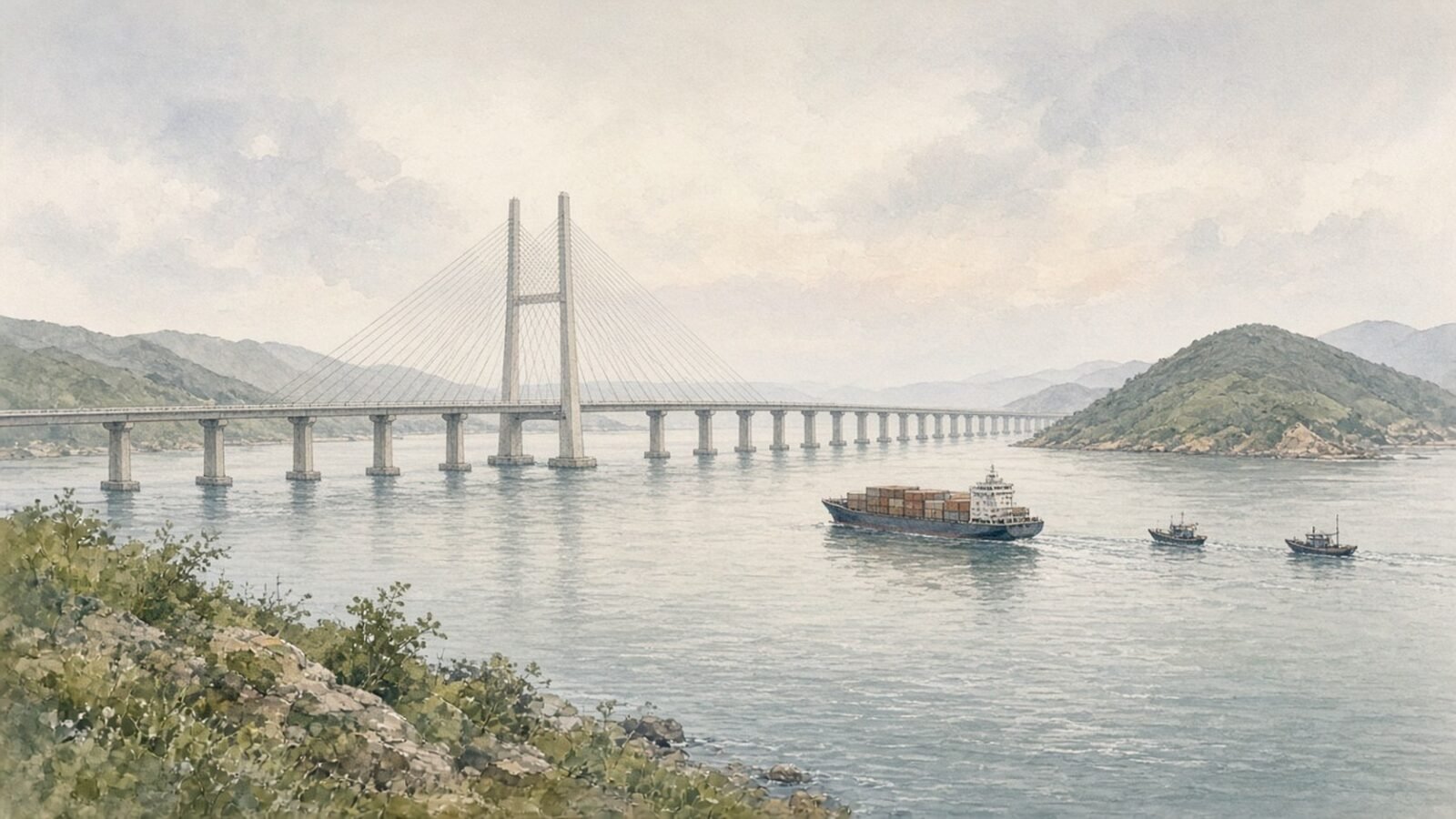
The first is the Hong Kong-Zhuhai-Macao Bridge, opened by Xi Jinping on 23 October 2018 and to traffic the next day. With its link roads it runs about 55 kilometres. The main crossing, about 41.6 kilometres, includes a 6.7-kilometre immersed tunnel between two artificial islands to keep shipping lanes clear. It gave the delta’s west side its first road link to Hong Kong, but for years it carried far fewer vehicles than forecast. A Hong Kong government paper put average daily traffic in 2019 at about 4,000 vehicles, well below projections, mainly because cross-border car licences were so restricted. Traffic rose after July 2023, when the “Northbound Travel for Hong Kong Vehicles” scheme let Hong Kong private cars drive into Guangdong, and the Zhuhai checkpoint reported record flows in 2024. The bridge still has three border crossings at its landing points, not one.
The second is the Guangzhou-Shenzhen-Hong Kong Express Rail Link, whose Hong Kong section opened on 23 September 2018, putting West Kowloon under twenty minutes from Shenzhen Futian and joining Hong Kong to the national network described in our bullet-train post. Its political cost was “co-location”: part of West Kowloon station became a Mainland Port Area where mainland law applies. Critics called this a breach of the Basic Law; Hong Kong’s Court of Appeal upheld it in 2021.
The third is the Shenzhen-Zhongshan Link, a 24-kilometre bridge-and-tunnel crossing opened on 30 June 2024, which cut a trip of around two hours to about thirty minutes. The older Humen and Nansha bridges upstream are covered in the Dongguan post. Together, these crossings are turning the estuary from a barrier into a middle.
The fourth is less visible: intercity rail. The Guangfo line between Guangzhou and Foshan opened on 3 November 2010 and was hailed as China’s first intercity metro. Guangdong has since built intercity railways linking Guangzhou with Foshan, Zhaoqing, Dongguan, Huizhou, Zhuhai and Jiangmen, and the metro systems of Guangzhou, Shenzhen, Foshan and Dongguan reach towards one another. For many Guangzhou-Foshan commuters the city boundary is now an administrative detail. Urban rail across China is covered in our metro post.
Ports and airports tell a more competitive story. In 2024 Shenzhen handled about 33 million twenty-foot equivalent units (TEU) of containers and Guangzhou, including Nansha, about 25–26 million depending on the source. Hong Kong, once the world’s busiest container port, handled about 13.7 million, down 5.6%, as cargo increasingly moves directly through mainland ports (see our post on port rankings). Five significant airports sit within about 150 kilometres: Hong Kong, Guangzhou Baiyun, Shenzhen Bao’an, Macau and Zhuhai. Hong Kong commissioned its three-runway system on 28 November 2024, and Guangzhou and Shenzhen are expanding too. Planners call this complementary development; sceptics call it duplication.
An innovation corridor with special zones
The plan’s biggest ambition was innovation. Guangdong published a plan for a Guangzhou-Shenzhen science and technology innovation corridor in 2017, and the 2019 plan widened it to Guangzhou-Shenzhen-Hong Kong-Macao. The idea is that Hong Kong’s universities and capital markets, Shenzhen’s technology firms and Guangzhou’s research and industry can together do what none could alone. Regional champions such as BYD, DJI and Huawei (see our Ren Zhengfei and Jensen Huang comparison) have their own posts.
WIPO’s Global Innovation Index, which ranks clusters by patent filings, scientific publications and, since 2025, venture capital deals, placed the “Shenzhen-Hong Kong-Guangzhou” cluster second behind Tokyo-Yokohama for several years. In the 2025 edition it moved to first, largely on venture capital. The ranking measures activity inside a region drawn by WIPO’s own method, not the success of GBA policy, but it does confirm one of the world’s densest knowledge economies.
Four special zones serve as laboratories for cross-border rules:
- Qianhai, in western Shenzhen, hosts services cooperation with Hong Kong; in September 2021 it grew from about 15 to about 120 square kilometres.
- Hengqin, the Zhuhai island beside Macau, became the Guangdong-Macao In-Depth Cooperation Zone under a plan issued in September 2021, jointly run to give Macau room to diversify; our Macau post covers it.
- Nansha, Guangzhou’s estuary district, received a master plan in June 2022 for deeper cooperation with Hong Kong and Macau.
- Hetao, the Shenzhen-Hong Kong Science and Technology Innovation Cooperation Zone, spans the border: a Hong Kong park of about 0.87 square kilometres on the Lok Ma Chau Loop, a former river meander that ended up on Hong Kong’s side when the Shenzhen River was straightened, and a Shenzhen park just to the north, whose development plan was issued in August 2023. The aim is special rules for moving researchers, samples and data across.
The zones show how integration proceeds in the region: territory by territory, with bespoke rules, rather than by removing the border.
Other megaregions compared
The Greater Bay Area is one of China’s three coastal giants, with Beijing-Tianjin-Hebei and the Yangtze River Delta, as noted in our post on China’s new cities. The Yangtze River Delta integration plan, issued in December 2019, covers Shanghai, Jiangsu, Zhejiang and Anhui: about 358,000 square kilometres, 41 cities and well over 200 million people. Published regional totals put its 2024 GDP at about 33 trillion yuan, around a quarter of China’s. It is bigger on most measures but far less dense, and it has no internal customs borders. Shanghai’s side of that story is in our Pudong post and Old Shanghai and the International Settlement.
Greater Tokyo, usually counted at around 37 million people, is the most integrated giant metropolis, bound by one government and a dense rail network. Gottmann’s Boston-Washington corridor, roughly 50 million people depending on definition, grew with little regional planning. The Greater Bay Area sits between them: more planned than the American corridor, more fragmented than Tokyo, and unique in containing two self-governing territories with their own currencies.
The critiques
The first critique is that integration is limited by design. The plan promises smoother flows of people, goods, capital and information, but each crosses a border kept for political reasons, so schemes begin with quotas and pilot lists, and social insurance, healthcare and schooling for Hong Kong families in the mainland cities remain complicated. Hong Kong critics say integration runs one way; supporters reply that Hong Kong’s distinct system is exactly what the region is meant to preserve.
The second concerns Hong Kong’s role. The plan cast it as the region’s financial and legal gateway, and it still is. But the 2019 protests, the 2020 National Security Law and pandemic border closures changed the terms. Official estimates show Hong Kong’s population falling from about 7.51 million in mid-2020 to 7.29 million in mid-2022, reflecting emigration as well as the pandemic, before recovering to about 7.53 million by mid-2024 as talent schemes brought in newcomers. After the border reopened in 2023, weekend trips to Shenzhen for cheaper meals, groceries and entertainment became a mass habit, and Hong Kong retailers complained of lost trade. That is integration, but a reversal of the 1980s flow. Hong Kong institutions such as HSBC and the South China Morning Post have their own posts.
The third is housing. Hong Kong has for years ranked at or near the top of international housing-unaffordability surveys, and Shenzhen’s price-to-income ratios are among mainland China’s highest. The mainland property slump since 2021 has eased prices but exposed the finances of developers and local governments.
The fourth is overbuilding. Several airports, three big container ports and many new districts all promoted as growth poles suggest duplication and a reliance on debt-financed construction. The bridge’s empty early years became a symbol of this, although later traffic growth blunted the point.
The fifth is demographics. The mainland cities are relatively young because they draw migrants, and Guangdong recorded about 1.13 million births in 2024. But Hong Kong and Macau have some of the world’s lowest fertility rates, below one child per woman, and fast-ageing populations. The region must keep attracting people from a country whose population is now shrinking.
A region still under construction
The Pearl River Delta has been imagined as one city for most of the reform era. First it was a provincial economic zone, then a national reform area, then a World Bank statistic and finally a Greater Bay Area with eleven cities and a 2035 horizon. Physically, the imagining has largely come true. The towns of the 1980s have fused, the estuary is crossed by bridges and tunnels, and the region’s economy ranks with those of the world’s great metropolitan areas.
Politically and institutionally, the fusion is deliberately incomplete. Gottmann’s megalopolis was defined by how its parts had grown together without anyone intending it. The Greater Bay Area is defined by an intention to join things that are also meant to remain separate. The next decade will show whether “one country, two systems” can be managed as an advantage for a single urban economy or whether it will remain the border that the bridges are built across.